MyTopo
Mill Spring Missouri US Topo Map
Couldn't load pickup availability
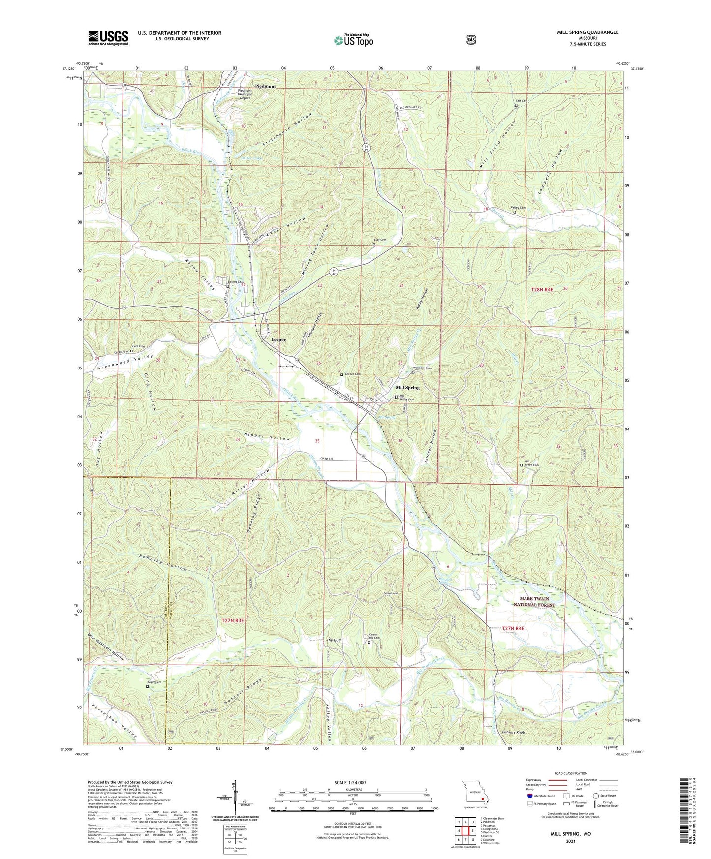
2021 topographic map quadrangle Mill Spring in the state of Missouri. Scale: 1:24000. Based on the newly updated USGS 7.5' US Topo map series, this map is in the following counties: Wayne, Carter. The map contains contour data, water features, and other items you are used to seeing on USGS maps, but also has updated roads and other features. This is the next generation of topographic maps. Printed on high-quality waterproof paper with UV fade-resistant inks.
Quads adjacent to this one:
West: Ellington SE
Northwest: Clearwater Dam
North: Piedmont
Northeast: Patterson
East: Piedmont SE
Southeast: Williamsville
South: Ellsinore
Southwest: Hunter
Contains the following named places: Bear Mountain Hollow, Benning Hollow, Benning Ridge, Big Brushy Creek, Bowles Cemetery, Boyer Cemetery, Brewer Bay, Bunkers Knob, Bunkers Knob Picnic Area, Bunyard Spring, Carson Hill, Carson Hill Church, Carson Hill School, Carter Lake, Cedar Bay, Clay Cemetery, Dry Creek, Dry Creek School, Evans Hollow, Gaylor, Ging Hollow, Gravel Pit, Greenwood Valley, Hassell Ridge, Hay Hollow, Horseshoe Valley, Ijam Hill School, Ijams Hill Church, Johnson Hollow, Kelley Cemetery, Kelley Valley, Kelow Valley, Kenny Hollow, Lambert Hollow, Leeper, Leeper Cemetery, Little Brushy Creek, McKenzie Creek, Middle Brushy Creek, Mill Creek, Mill Creek Cemetery, Mill Creek School, Mill Field Hollow, Mill Spring, Mill Spring Creek, Miller Hollow, Mining Town Hollow, Mount Olive Church, Newtown Hollow, Nipper Hollow, Piedmont Municipal Airport, Scott Cemetery, Self Cemetery, Shady Nook Church, Shady Nook School, Spur Number 2, Stillhouse Hollow, The Gulf, Township of Mill Spring, Village of Mill Spring, Warmack Cemetery, Wingo Slough, ZIP Codes: 63952, 63957