MyTopo
Clearwater Dam Missouri US Topo Map
Couldn't load pickup availability
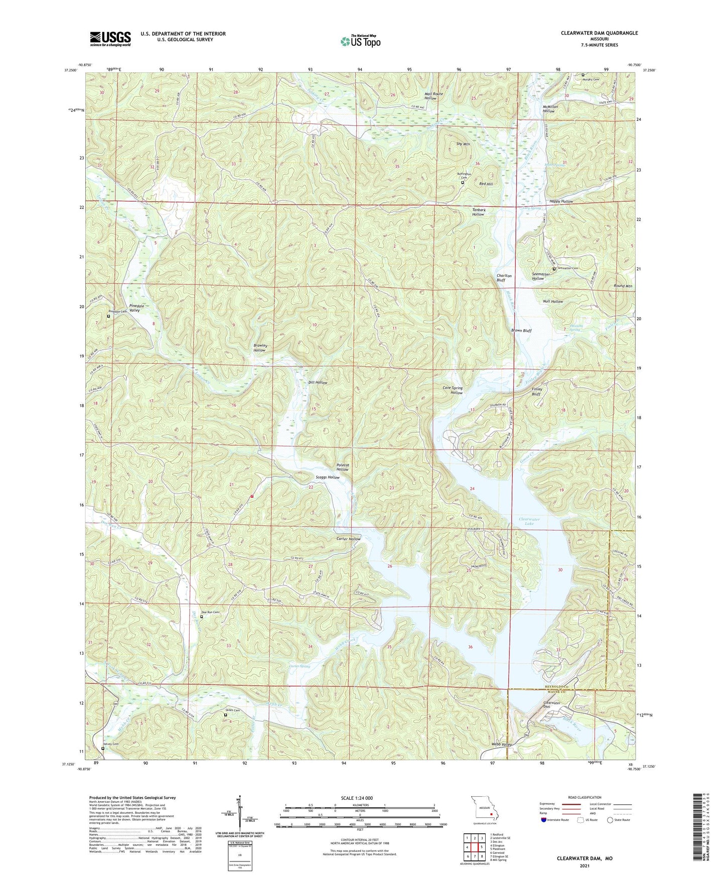
2021 topographic map quadrangle Clearwater Dam in the state of Missouri. Scale: 1:24000. Based on the newly updated USGS 7.5' US Topo map series, this map is in the following counties: Reynolds, Wayne. The map contains contour data, water features, and other items you are used to seeing on USGS maps, but also has updated roads and other features. This is the next generation of topographic maps. Printed on high-quality waterproof paper with UV fade-resistant inks.
Quads adjacent to this one:
West: Ellington
Northwest: Redford
North: Lesterville SE
Northeast: Des Arc
East: Piedmont
Southeast: Mill Spring
South: Ellington SE
Southwest: Garwood
This map covers the same area as the classic USGS quad with code o37090b7.
Contains the following named places: Bluff View Public Use Area, Bozarth State Forest, Brawley Hollow, Brown Bluff, Buffington Cemetery, Buffington School, Carter Hollow, Carter Mill School, Carter Spring, Cave Spring Hollow, Charlton Bluff, Clearwater Dam, Clearwater Lake, Clearwater Lake State Wildlife Management Area, Dill Hollow, Doe Run Cemetery, Doe Run Creek, Finley Bluff, Finley Branch, Goose Creek, Graves Mountain State Forest, Happy Hollow, Helvey, Helvey Cemetery, Logan Creek, Lower Doe Run Church, Lucy Spring, Mail Route Hollow, Mann Spring, McMillan Hollow, Murphy Cemetery, North Fork Webb Creek, Null Hollow, Piedmont Park Public Use Area, Pinedale Cemetery, Pinedale School, Pinedale Valley, Pleasant Spring, Pleasant Spring School, Polecat Hollow, Potter Branch, Red Hill, River Road Public Use Area, Riverside, Riverside Wilderness Camping Site, Round Mountain, Scaggs Hollow, Seematter Cemetery, Seematter Hollow, Shy Mountain, Sinking Creek, Skiles Cemetery, Tanbark Hollow, Thurman Point Public Use Area, Township of Webb, Webb, Webb Creek, Webb Creek Public Use Area, Webb Creek Volunteer Fire Department, Webb Valley