MyTopo
Millersburg SW Missouri US Topo Map
Couldn't load pickup availability
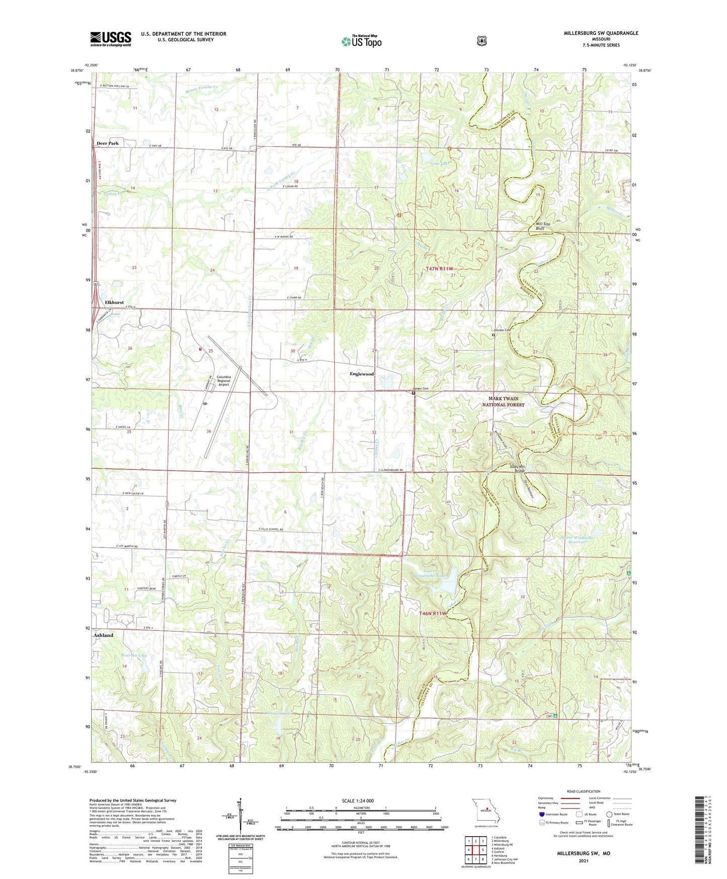
2021 topographic map quadrangle Millersburg SW in the state of Missouri. Scale: 1:24000. Based on the newly updated USGS 7.5' US Topo map series, this map is in the following counties: Boone, Callaway. The map contains contour data, water features, and other items you are used to seeing on USGS maps, but also has updated roads and other features. This is the next generation of topographic maps. Printed on high-quality waterproof paper with UV fade-resistant inks.
Quads adjacent to this one:
West: Ashland
Northwest: Columbia
North: Millersburg
Northeast: Millersburg NE
East: Guthrie
Southeast: New Bloomfield
South: Jefferson City NW
Southwest: Hartsburg
Contains the following named places: Ashland Lake, Barger Cemetery, Barnes Chapel, Barnes School, Bass Lake, Big Branch, Cedar Creek Hiking Trail, City of Ashland, Columbia Regional Airport, Curry Lake, Devils Backbone, Doctor Windmiller Dam, Doctor Windmiller Reservoir, Dry Fork, Duley Mill Bridge, Duncan School, Ellis School, Englewood, Englewood School, Eugene Windmiller Lake, Ginlet, Ginn Lake, Ginn Lake Dam, Johnson Cemetery, Laboratory Dam, Mid Missouri P and DF Post Office, Mill Site Bluff, Millers, Millers Creek, North Fork Turkey Creek, Oak Chapel, Owl Creek, Peterson Lake, Peterson Lake Dam, Pine Ridge Picnic Grounds, Smith Creek, South Fork Turkey Creek, Southern Boone County Fire Protection District Station 19, Stump Creek, Summerville, University of Missouri Ashland Wildlife Research Area, Windmiller Dam Number 1, Windmiller Dam Number 2, ZIP Code: 65010