MyTopo
Millersville Missouri US Topo Map
Couldn't load pickup availability
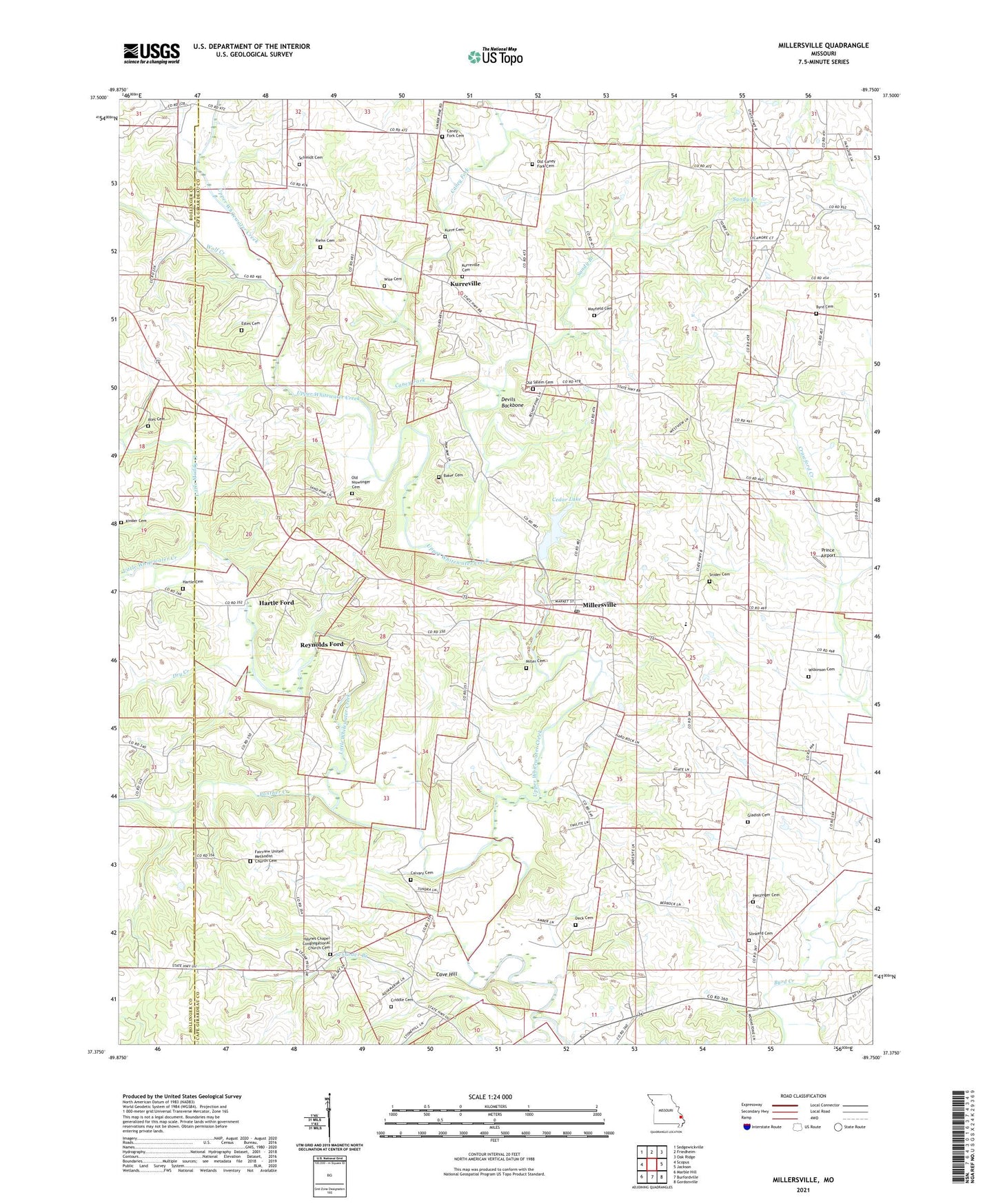
2021 topographic map quadrangle Millersville in the state of Missouri. Scale: 1:24000. Based on the newly updated USGS 7.5' US Topo map series, this map is in the following counties: Cape Girardeau, Bollinger. The map contains contour data, water features, and other items you are used to seeing on USGS maps, but also has updated roads and other features. This is the next generation of topographic maps. Printed on high-quality waterproof paper with UV fade-resistant inks.
Quads adjacent to this one:
West: Scopus
Northwest: Sedgewickville
North: Friedheim
Northeast: Oak Ridge
East: Jackson
Southeast: Gordonville
South: Burfordville
Southwest: Marble Hill
Contains the following named places: Ates Cemetery, Baker Cemetery, Big Spring School, Byrd Cemetery, Calvary Cemetery, Caney Fork, Caney Fork Cemetery, Caney Fork Church, Cave Hill, Cedar Lake, Cedar Lake Dam, Crawford Creek, Criddle Cemetery, Deck Cemetery, Devils Backbone, Dry Creek, Estes Cemetery, Fairview Church, Fulbright School, Gladish Cemetery, Gravel Hill Church, Hartle Cemetery, Hartle Ford, Hartle School, Haynes Chapel, Herzinger Cemetery, Kurre Cemetery, Kurreville, Link School, Little Muddy Creek, Little Whitewater Creek, Mayfield Cemetery, Miller Cemetery, Millersville, Millersville Census Designated Place, Millersville Church, Millersville Post Office, Millersville School, Neiswanger School, Niswonger Church, Number 815 Dam, Old Niswonger Cemetery, Old Salem Cemetery, Old Salem Church, Old Salem School, Panther Creek, Prince Airport, Reynolds Ford, Riehn Cemetery, Rieman School, Sandy Branch, Schmidt Cemetery, Schroder Branch, Schroder School, Slinkerd Cemetery, Snider Cemetery, Township of Whitewater, Wilkinson Cemetery, Wise Cemetery, Wolf Creek, ZIP Code: 63766