MyTopo
Scopus Missouri US Topo Map
Couldn't load pickup availability
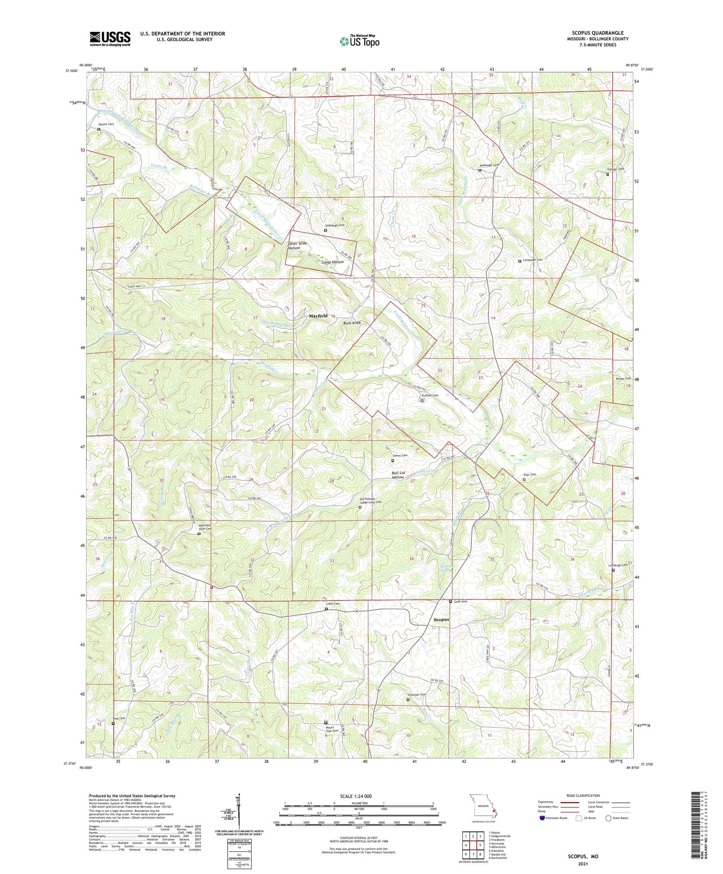
2021 topographic map quadrangle Scopus in the state of Missouri. Scale: 1:24000. Based on the newly updated USGS 7.5' US Topo map series, this map is in the following counties: Bollinger. The map contains contour data, water features, and other items you are used to seeing on USGS maps, but also has updated roads and other features. This is the next generation of topographic maps. Printed on high-quality waterproof paper with UV fade-resistant inks.
Quads adjacent to this one:
West: Hurricane
Northwest: Patton
North: Sedgewickville
Northeast: Friedheim
East: Millersville
Southeast: Burfordville
South: Marble Hill
Southwest: Glenallen
This map covers the same area as the classic USGS quad with code o37089d8.
Contains the following named places: Angle Ford, Baker Branch, Bess Cemetery, Big Hollow Branch, Bollinger Branch, Bollinger Ford, Bollinger School, Buck Knob, Bull Lot Hollow, Camp Hollow, Cedar Branch School, Cheek Creek, Chostner Cemetery, Church of Christ, Coles Cemetery, Coles School, Cook Cemetery, Cooks Branch, Dalton Cemetery, Dalton Ford, Fish Branch, German Branch, Holt Cemetery, James Cemetery, James Creek, James School, Kinder Ford, Limbaugh Cemetery, Limbaugh School, Little Whitewater Church, Lona Lou Lake, Lona Lou Lake Dam, Mayfield, Mayfield Creek, Mount Zion Church, Mountain View Cemetery, North County Fire Protection District Station 1, Old Pulliam - Judge Long Cemetery, Otter Slide Hollow, Pulliam Cemetery, Scopus, Seabaugh Cemetery, Seabaugh Ford, Seabaugh School, Sedgewickville Fire Protection District Station 2, Smith School, Stillhouse Spring, Township of Scopus, Trinity Church, Yantz Branch