MyTopo
Mitchellville Missouri US Topo Map
Couldn't load pickup availability
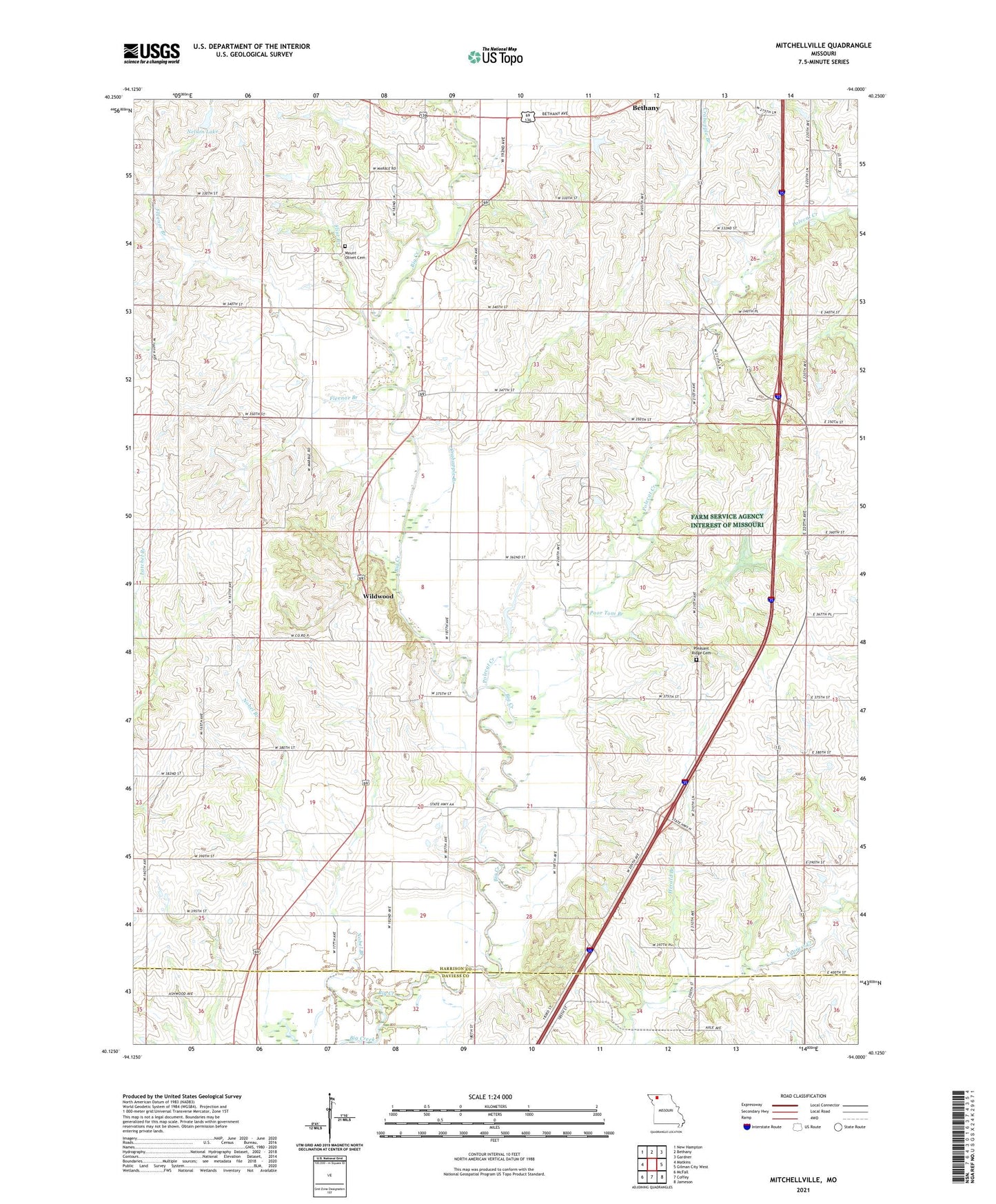
2021 topographic map quadrangle Mitchellville in the state of Missouri. Scale: 1:24000. Based on the newly updated USGS 7.5' US Topo map series, this map is in the following counties: Harrison, Daviess. The map contains contour data, water features, and other items you are used to seeing on USGS maps, but also has updated roads and other features. This is the next generation of topographic maps. Printed on high-quality waterproof paper with UV fade-resistant inks.
Quads adjacent to this one:
West: Matkins
Northwest: New Hampton
North: Bethany
Northeast: Gardner
East: Gilman City West
Southeast: Jameson
South: Coffey
Southwest: McFall
Contains the following named places: Brady School, Bridgeport, Bridgeport Church, Brush Oak School, Crabapple Branch, Fleenor Branch, Flint Branch, Happy Valley Post Office, Herald Branch, Hickory Grove School, Jack Oak School, Maize School, Miracle Hills Ranch, Mitchellville, Mitchellville Church, Mitchellville School, Mount Olivet Cemetery, Nelson Lake, Nelson Lake Dam, Nobel Branch, Pleasant Ridge, Pleasant Ridge Cemetery, Pleasant Ridge School, Polecat Creek, Poor Tom Branch, Rice Town School, Shiloh School, Township of Cypress, Union School, Wildwood, Woodland School, Youngs School