MyTopo
Jameson Missouri US Topo Map
Couldn't load pickup availability
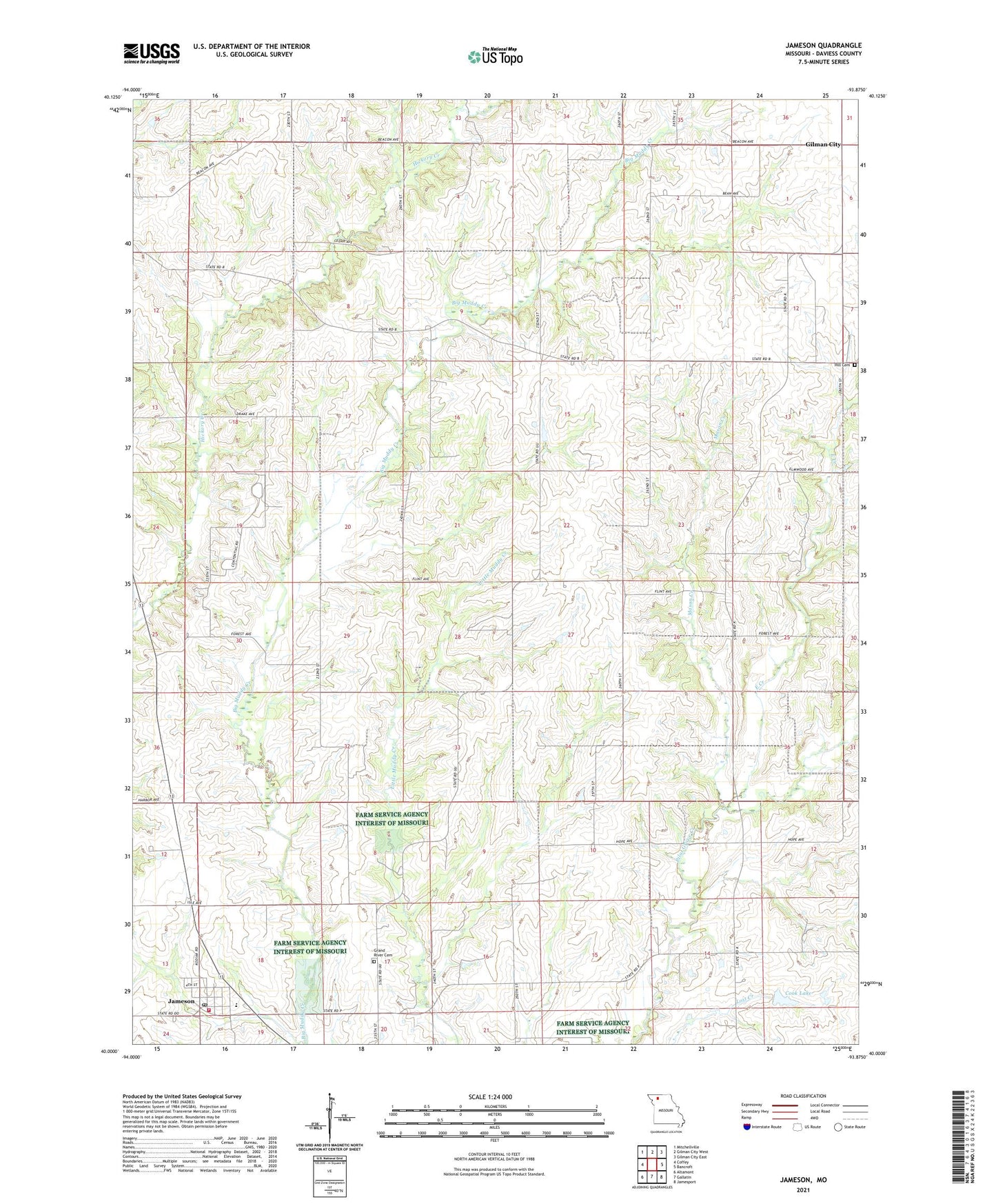
2021 topographic map quadrangle Jameson in the state of Missouri. Scale: 1:24000. Based on the newly updated USGS 7.5' US Topo map series, this map is in the following counties: Daviess. The map contains contour data, water features, and other items you are used to seeing on USGS maps, but also has updated roads and other features. This is the next generation of topographic maps. Printed on high-quality waterproof paper with UV fade-resistant inks.
Quads adjacent to this one:
West: Coffey
Northwest: Mitchellville
North: Gilman City West
Northeast: Gilman City East
East: Bancroft
Southeast: Jamesport
South: Gallatin
Southwest: Altamont
This map covers the same area as the classic USGS quad with code o40093a8.
Contains the following named places: Barnett School, Cook Lake, East Creek, East Dam, Excelsior School, Grand River Church, Hickory Creek Church, Hill Cemetery, Jameson, Jameson Post Office, Jameson Volunteer Fire Protection District, Land School, Madelaine, Mason Creek, McCleary School, Netherton School, North Daviess High School, Prairie City Church, Scotland School, Smith School, Town of Jameson, Township of Grand River, Township of Washington, ZIP Codes: 64636, 64647