MyTopo
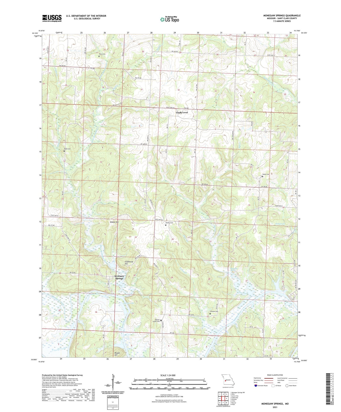
Monegaw Springs Missouri US Topo Map
Couldn't load pickup availability
2021 topographic map quadrangle Monegaw Springs in the state of Missouri. Scale: 1:24000. Based on the newly updated USGS 7.5' US Topo map series, this map is in the following counties: St. Clair. The map contains contour data, water features, and other items you are used to seeing on USGS maps, but also has updated roads and other features. This is the next generation of topographic maps. Printed on high-quality waterproof paper with UV fade-resistant inks.
Quads adjacent to this one:
West: Taberville
Northwest: Monegaw Springs NW
North: Ohio
Northeast: Lowry City
East: Osceola
Southeast: Vista
South: Roscoe
Southwest: Tiffin
Contains the following named places: Benton Green Cemetery, Benton Green School, Chalk Level, Chalk Level Church, Chalk Level School, Clubhouse Hill, Concord Church, Cooks Chapel, Finley Creek, Kibbie Hill, Kidds Chapel, Lewellan School, Lewis School, Little Monegaw Creek, Magnolia Spring, Mills Lake Dam, Monegaw Creek, Monegaw School, Monegaw Springs, Motley Cemetery, Motley School, Number 565 Dam, Parks Cemetery, Parks School, Pleasant Valley School, Reader Hill, Red Rock School, Saint Clair County, Salt Creek, Shady Grove Church, Silver Creek, Spill Creek, Spring Lake, Terry Cemetery, Thomas Cemetery, Township of Center, Upps Resort Lake Dam, Washington School, Wixted Airport, Yeater Cemetery, Yellow Creek, Youngers Lookout