MyTopo
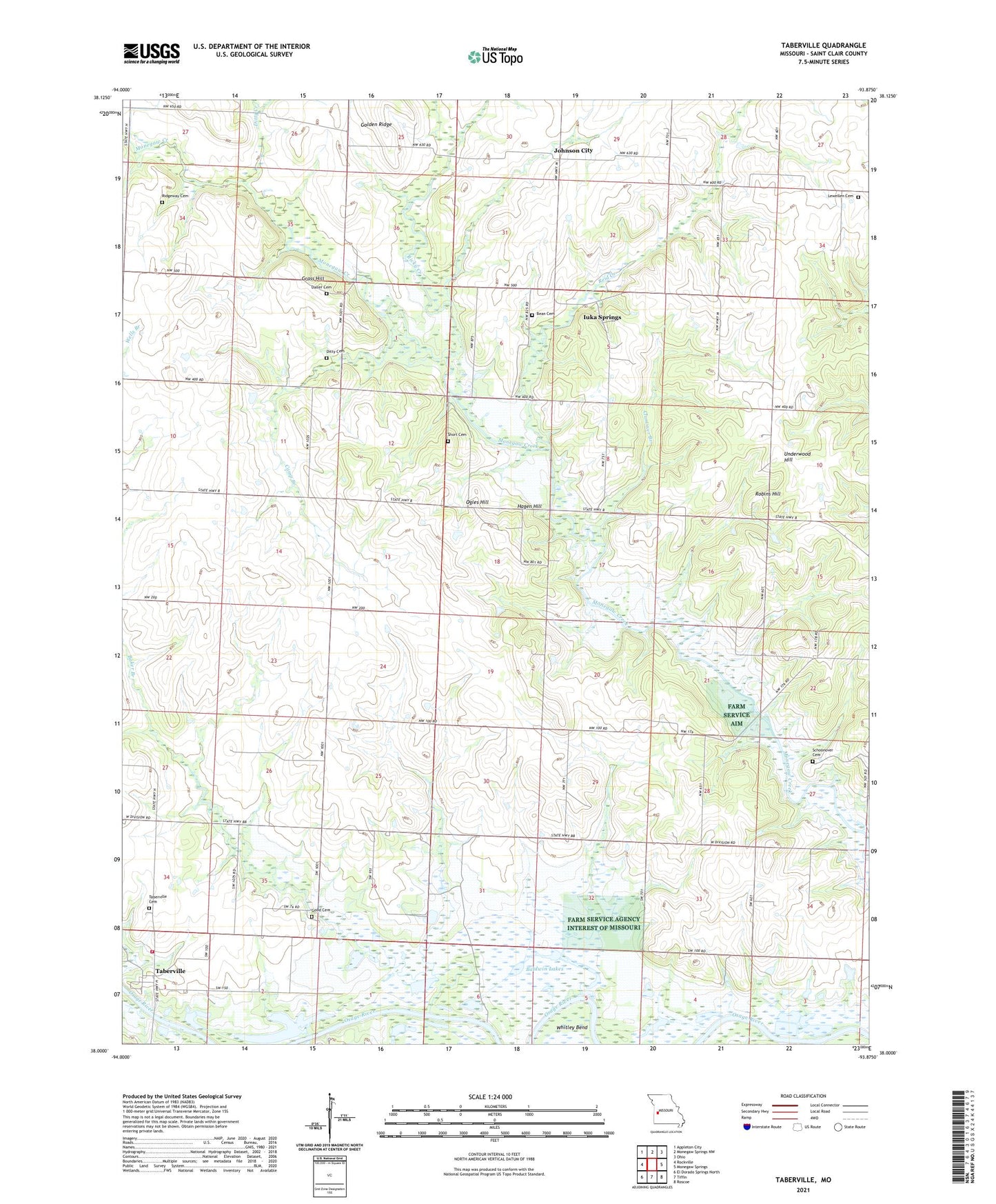
Taberville Missouri US Topo Map
Couldn't load pickup availability
2021 topographic map quadrangle Taberville in the state of Missouri. Scale: 1:24000. Based on the newly updated USGS 7.5' US Topo map series, this map is in the following counties: St. Clair. The map contains contour data, water features, and other items you are used to seeing on USGS maps, but also has updated roads and other features. This is the next generation of topographic maps. Printed on high-quality waterproof paper with UV fade-resistant inks.
Quads adjacent to this one:
West: Rockville
Northwest: Appleton City
North: Monegaw Springs NW
Northeast: Ohio
East: Monegaw Springs
Southeast: Roscoe
South: Tiffin
Southwest: El Dorado Springs North
This map covers the same area as the classic USGS quad with code o38093a8.
Contains the following named places: Baker Branch, Baldwin Lakes, Bean Cemetery, Bethel Church, Blue Mound School, Camp Branch, Clammer Branch, Daller Cemetery, Ditty Cemetery, Ditty Creek, Golden Ridge, Good Cemetery, Grass Hill, Green Valley Church, Hagen Hill, Harmony Church, Hays Mine, Hoover School, Iuka Springs, Johnson City, Johnson City School, Lewellen Cemetery, Mount Zion Church, Ogles Hill, Old Short Mine, Prairie Home School, Reid Creek, Rich Valley School, Ricky Creek, Ridgeway Cemetery, Robins Hill, Schoonover Cemetery, Short Cemetery, Simms Creek, Spring Grove School, Taberville, Taberville Cemetery, Taberville Community Volunteer Fire Department, Taberville Public Access, Taberville School, Township of Osage, Underwood Hill, Upper Monegaw School, Whitley Bend