MyTopo
Nashua Missouri US Topo Map
Couldn't load pickup availability
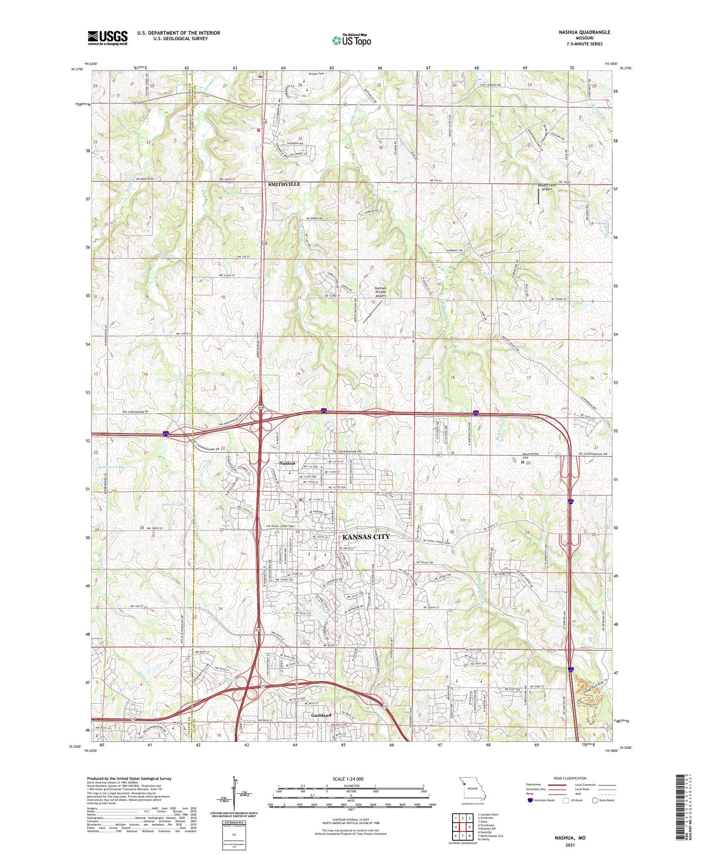
2021 topographic map quadrangle Nashua in the state of Missouri. Scale: 1:24000. Based on the newly updated USGS 7.5' US Topo map series, this map is in the following counties: Clay, Platte. The map contains contour data, water features, and other items you are used to seeing on USGS maps, but also has updated roads and other features. This is the next generation of topographic maps. Printed on high-quality waterproof paper with UV fade-resistant inks.
Quads adjacent to this one:
West: Ferrelview
Northwest: Camden Point
North: Smithville
Northeast: Arley
East: Kearney SW
Southeast: Liberty
South: North Kansas City
Southwest: Parkville
Contains the following named places: Amory, Barry School, Bell Lake, Bell Lake Dam, Bell Prairie Elementary School, Bell School, Church of Christ, Dunham Airport, First Creek, Fox Hill Elementary School, Gordon School, Greater Monumental Baptist Church of Jesus Christ, Holy Family Parish Church, Kansas City Missouri Fire Department Station 3, KCMO-AM (Kansas City), KGGN-AM (Gladstone), King of Kings Lutheran Church, Lone Star School, Martin School, Mitchell School, Mount Olive Church, Nashua, Nashua Baptist Church, Nashua Elementary School, National American University Zona Rosa Campus, New Life Community Church, New Mark Middle School, Northview Elementary School, Number 178 Dam, Pathfinder Elementary School, Polecat Creek, Resurrection Cemetery, Rocky Branch, Rollert Farm Airport, Sampson Lake, Smithville Area Fire Protection District, Smithville Middle School, Smithville Post Office, Smithville Upper Elementary School, Staley High School, Stevens Lake, Stevens Lake Dam, Woods School, ZIP Codes: 64155, 64156, 64165, 64166