MyTopo
Arley Missouri US Topo Map
Couldn't load pickup availability
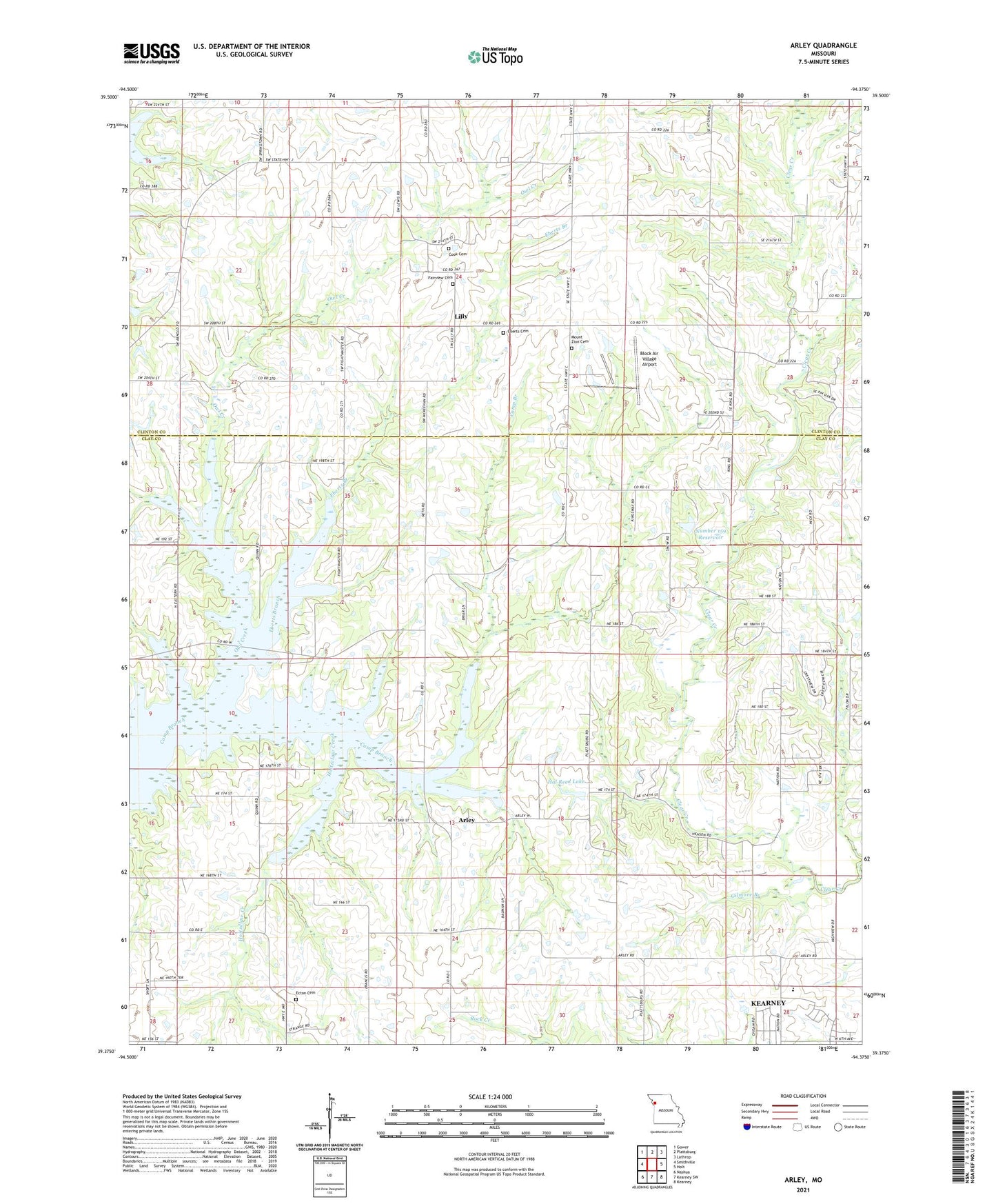
2021 topographic map quadrangle Arley in the state of Missouri. Scale: 1:24000. Based on the newly updated USGS 7.5' US Topo map series, this map is in the following counties: Clay, Clinton. The map contains contour data, water features, and other items you are used to seeing on USGS maps, but also has updated roads and other features. This is the next generation of topographic maps. Printed on high-quality waterproof paper with UV fade-resistant inks.
Quads adjacent to this one:
West: Smithville
Northwest: Gower
North: Plattsburg
Northeast: Lathrop
East: Holt
Southeast: Kearney
South: Kearney SW
Southwest: Nashua
This map covers the same area as the classic USGS quad with code o39094d4.
Contains the following named places: Arley, Arley School, Bethel German Methodist Episcopal Church, Block Air Village Airport, Bodoc School, Clay County Sportsmans Club Lake Dam, Cook Cemetery, Downing School, Eberts Branch, Eberts Cemetery, Ecton Cemetery, Fairview Cemetery, Gilmore Branch, Hal Reed Dam, Hal Reed Lake, Holtzclaw Creek, Lilly, Lily School, Mac's Field, Mount Gilead Church, Mount Gilead School, Mount Zion Cemetery, Number 159 Reservoir, Number 161 Dam, Number 161 Reservoir, Oakland School, Owl Creek, Sunnyside School, Township of Clinton, Township of Kearney, Whetsett School