MyTopo
Ferrelview Missouri US Topo Map
Couldn't load pickup availability
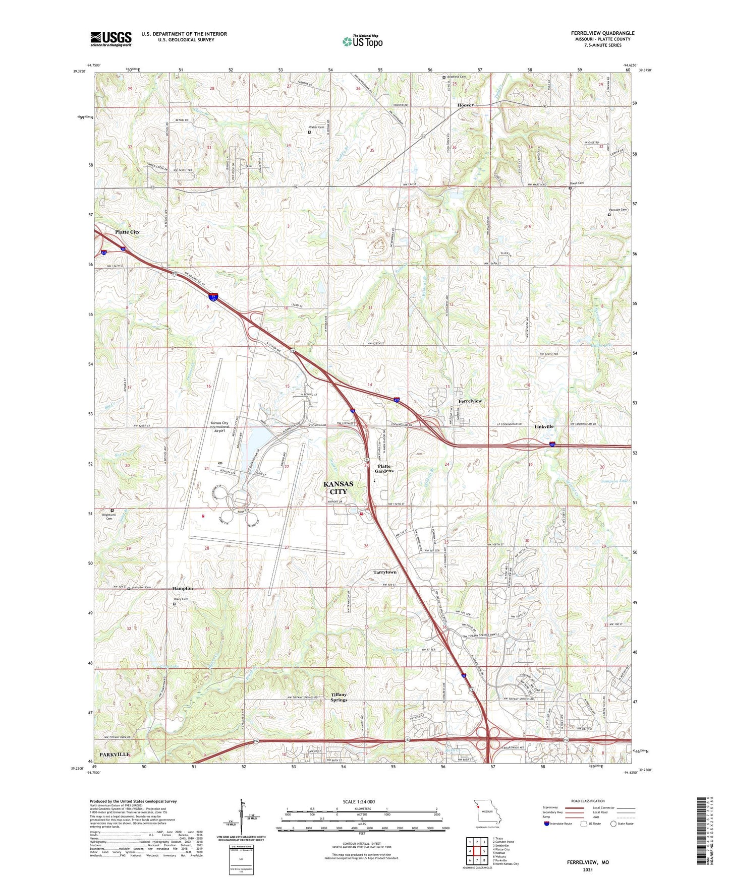
2021 topographic map quadrangle Ferrelview in the state of Missouri. Scale: 1:24000. Based on the newly updated USGS 7.5' US Topo map series, this map is in the following counties: Platte. The map contains contour data, water features, and other items you are used to seeing on USGS maps, but also has updated roads and other features. This is the next generation of topographic maps. Printed on high-quality waterproof paper with UV fade-resistant inks.
Quads adjacent to this one:
West: Platte City
Northwest: Tracy
North: Camden Point
Northeast: Smithville
East: Nashua
Southeast: North Kansas City
South: Parkville
Southwest: Wolcott
This map covers the same area as the classic USGS quad with code o39094c6.
Contains the following named places: Basswood Dam, Basswood Lake, Berlin Reservoir, Berry School, Brasfield Cemetery, Brightwell Cemetery, Dixon Cemetery, East Platte School, Executive Hills Polo Club Heliport, Ferrelview, Fountain Waller Cemetery, Grantham University, Gray Lake, Gray Lake Dam, Hampton, Hampton Cemetery, Hampton School, Hanks Lake, Hanks Lake Dam, Hayes Creek, Hoover, International Airport Dam, Jesse M Donaldson Post Office, Kansas City International Airport, Kansas City Missouri Fire Department Station 16, Kansas City Missouri Fire Department Station 5, Life Christian Academy, Linkville, Miller School, North Heartland Community Church, Oak Grove School, Pancake Cemetery, Park School, Platte Gardens, Prairie View School, Rivers of Life Church, Rixey Cemetery, Roanridge Institute, Sampson Lake Dam, Second Creek Church, Second Creek School, South Gale School, Tarrytown, Tiffany Landing Shopping Center, Tiffany Springs, Todd Creek School, Township of Carroll, Township of May, Village of Ferrelview, Wildcat Branch, ZIP Codes: 64153, 64154, 64163, 64164