MyTopo
Camden Point Missouri US Topo Map
Couldn't load pickup availability
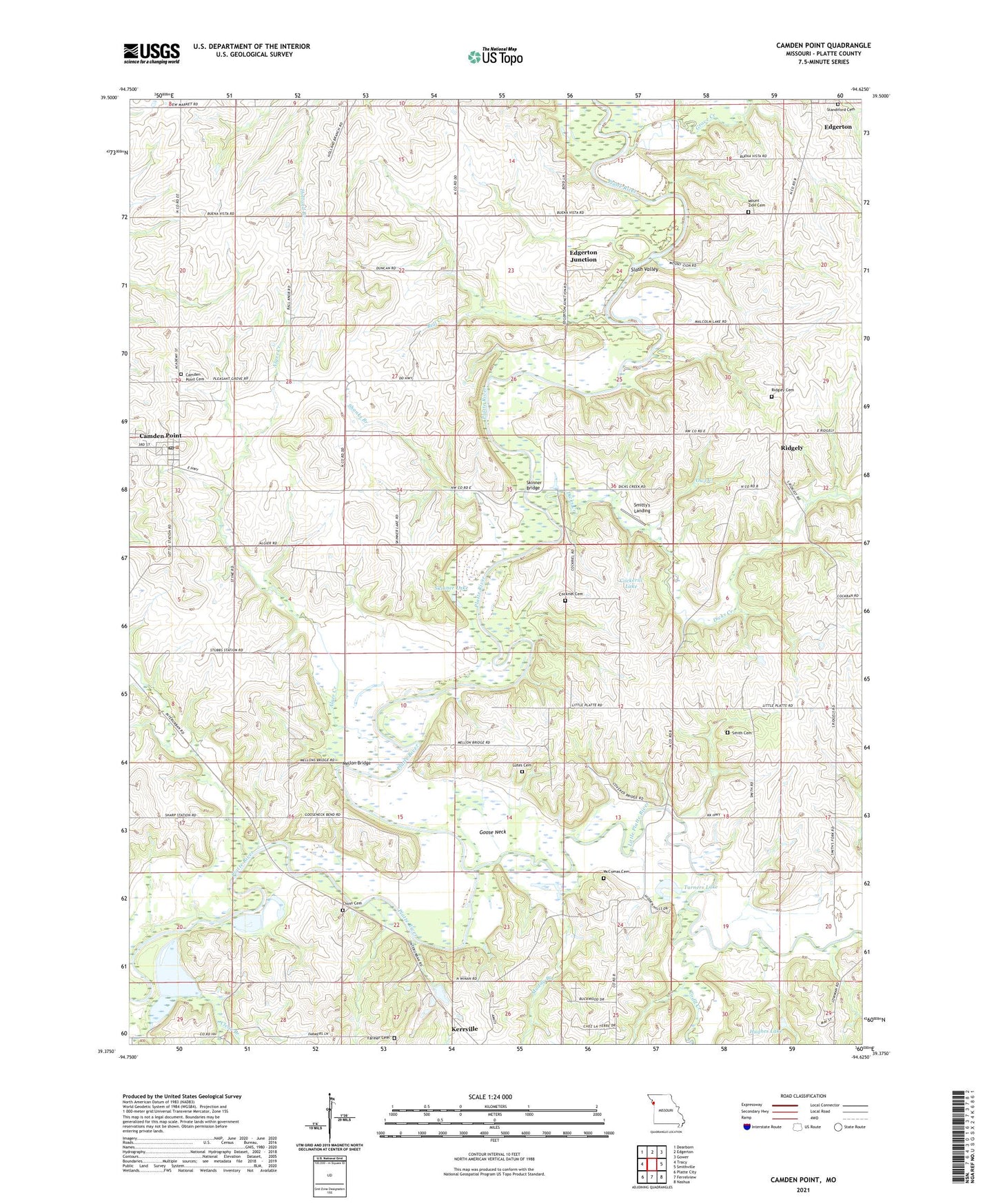
2021 topographic map quadrangle Camden Point in the state of Missouri. Scale: 1:24000. Based on the newly updated USGS 7.5' US Topo map series, this map is in the following counties: Platte. The map contains contour data, water features, and other items you are used to seeing on USGS maps, but also has updated roads and other features. This is the next generation of topographic maps. Printed on high-quality waterproof paper with UV fade-resistant inks.
Quads adjacent to this one:
West: Tracy
Northwest: Dearborn
North: Edgerton
Northeast: Gower
East: Smithville
Southeast: Nashua
South: Ferrelview
Southwest: Platte City
This map covers the same area as the classic USGS quad with code o39094d6.
Contains the following named places: Alger Creek, Assembly of God Church, Bell Creek, Buckeye School, Camden Point, Camden Point Cemetery, Camden Point Post Office, Centenary Church, Chinn Cemetery, City of Camden Point, Clear Branch, Cockerill Lake, Cockriel Cemetery, Collins School, Dicks Creek, Edgerton Junction, Farmer Cemetery, Franklin School, Goose Neck, Grove Creek, Horn School, Hughes Lake, Junction Bridge, Junction Lake, Kerrville, Little Platte Church, Little Platte River, Lutes Cemetery, Malcolm Lake, McComas Cemetery, Mellon Bridge, Mount Zion Cemetery, Mount Zion School, Muddy Branch, Owl Creek, Pleasant View School, Ridgely, Ridgley Cemetery, Shanks Branch, Sharps Station, Skinner Bridge, Skinner Lake, Slash Valley, Smith Cemetery, Smitty's Landing, Standiford Cemetery, Styne School, Swamp School, Todd Creek, Township of Green, Township of Preston, Turners Lake, Village of Ridgely, ZIP Codes: 64018, 64444