MyTopo
Naylor Missouri US Topo Map
Couldn't load pickup availability
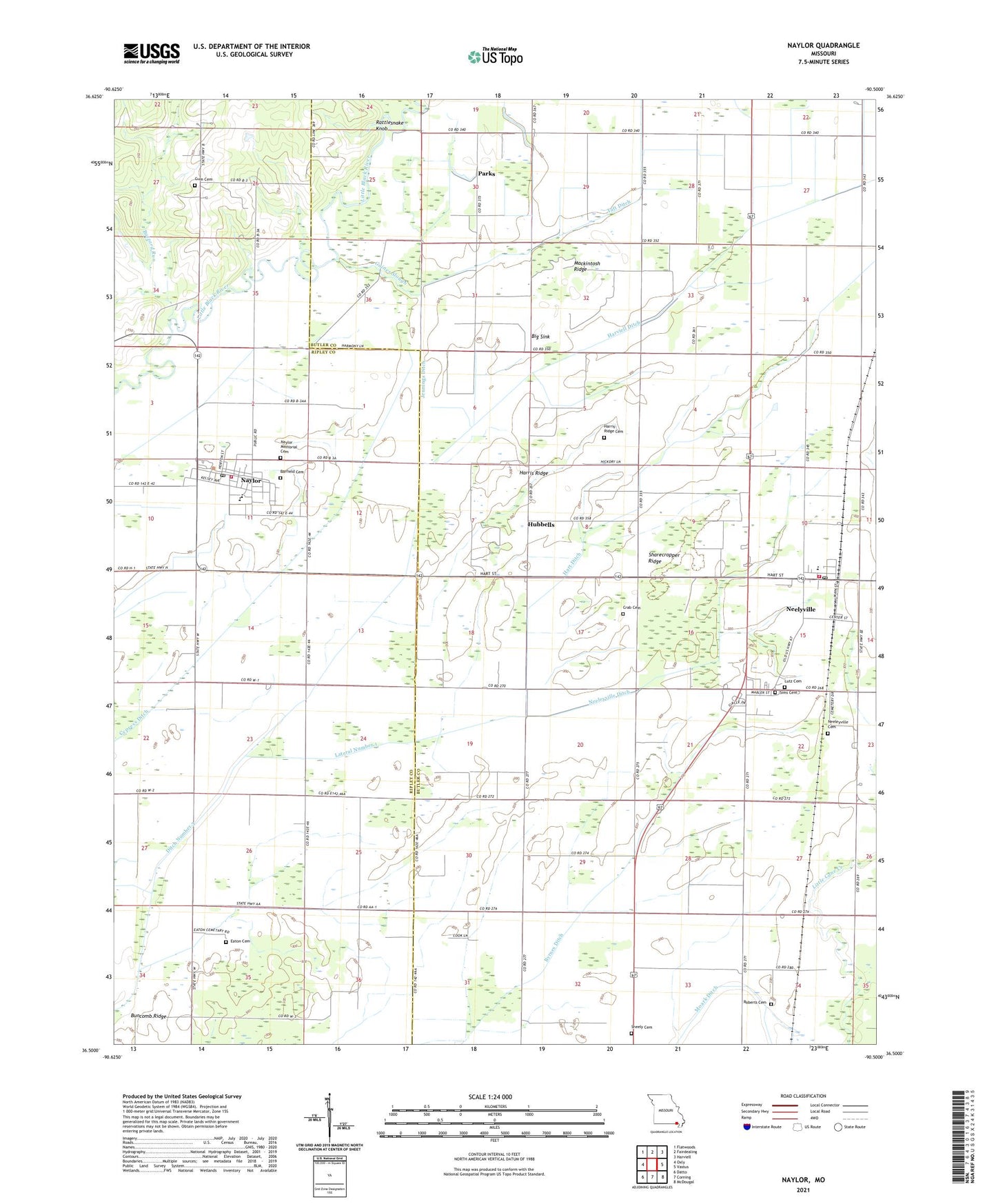
2021 topographic map quadrangle Naylor in the state of Missouri. Scale: 1:24000. Based on the newly updated USGS 7.5' US Topo map series, this map is in the following counties: Butler, Ripley. The map contains contour data, water features, and other items you are used to seeing on USGS maps, but also has updated roads and other features. This is the next generation of topographic maps. Printed on high-quality waterproof paper with UV fade-resistant inks.
Quads adjacent to this one:
West: Oxly
Northwest: Flatwoods
North: Fairdealing
Northeast: Harviell
East: Vastus
Southeast: McDougal
South: Corning
Southwest: Datto
This map covers the same area as the classic USGS quad with code o36090e5.
Contains the following named places: Barfield Cemetery, Beech Ridge School, Big Sink, Booser, Brown Ditch, Buncomb Church, Buncomb Ridge, Buncomb School, Butler County Fire Protection District Neelyville Station, Buzzard Run, Byrnes Ditch, City of Naylor, City of Neelyville, Corinth General Church, Crab Cemetery, Ditch Number 1, Ditch Number 3, Eaton Cemetery, Ferguson Switch, Friendship Church, Gaines Slough, Gaines Switch, Gheen, Gum Cemetery, Gum School, Harris Ridge, Harris Ridge Cemetery, Harris Ridge School, Hart Ditch, Hart School, Harviell Ditch, Hazel Dell School, Hubbells, Independence Church, Jennings Ditch, Jennings School, Lakeview Country Club, Lateral Number 1, Lutz Cemetery, Mackintosh Ridge, Mackintosh School, Mendosa, Moark Ditch, Naylor, Naylor Memorial Cemetery, Naylor Volunteer Fire Department, Neeleyville Cemetery, Neeleyville Ditch, Neelyville, Neelyville Post Office, Oakdale School, Parks, Rattlesnake Knob, Roberts Cemetery, Saint Margarite Mary Church, Sharecropper Ridge, Sheely Cemetery, Sims, Sims Cemetery, Sixteen to One School, State Line Church, Taft Ditch, Township of Neely, Walnut Grove Church