MyTopo
Fairdealing Missouri US Topo Map
Couldn't load pickup availability
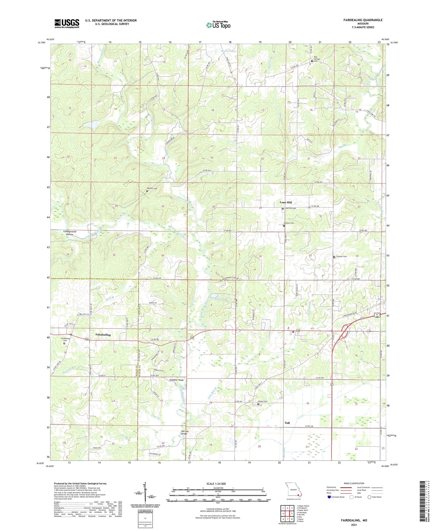
2021 topographic map quadrangle Fairdealing in the state of Missouri. Scale: 1:24000. Based on the newly updated USGS 7.5' US Topo map series, this map is in the following counties: Butler, Ripley. The map contains contour data, water features, and other items you are used to seeing on USGS maps, but also has updated roads and other features. This is the next generation of topographic maps. Printed on high-quality waterproof paper with UV fade-resistant inks.
Quads adjacent to this one:
West: Flatwoods
Northwest: Hogan Hollow
North: Stringtown
Northeast: Poplar Bluff
East: Harviell
Southeast: Vastus
South: Naylor
Southwest: Oxly
This map covers the same area as the classic USGS quad with code o36090f5.
Contains the following named places: Ball Mill Bridge, Bay Springs Cemetery, Bay Springs Church, Beaverdam Creek, Belcher, Belcher Post Office, Bethel Church, Burnham School, Butler County Fire Protection District Hillview Station, Campground Hollow, Case Bolt Branch, Cochran Cemetery, Cope Branch, Corinth Church, Dickens Cemetery, Dolly Branch, Fairdealing, Fairdealing Census Designated Place, Fairdealing Post Office, Forest Grove School, Fox Branch, Friendship Church, Gobbler Knob, Haw Branch, Hickory Grove School, Hillview School, Kenner Spring Branch, Kinsey Cemetery, Kremlin Mill, Kremlin School, Lone Hill, Lone Hill Cemetery, Lone Hill Church, Lone Hill Lookout Tower, Lone Hill School, Military Cemetery, Myers Lake, New Harmony Church, Oak Ridge Church, Oak Ridge School, Pleasant Hill School, Pleasant Valley School, Powers Mill, Resnick Lake, Resnik Lake Dam, Roxie, Russell Lake Dam, SEMO Camp, Spell Branch, Spell School, State Public Hunting Area, Taft, Township of Beaver Dam, Wattle Landing Strip, Wolf Creek, ZIP Code: 63945