MyTopo
New Hartford Missouri US Topo Map
Couldn't load pickup availability
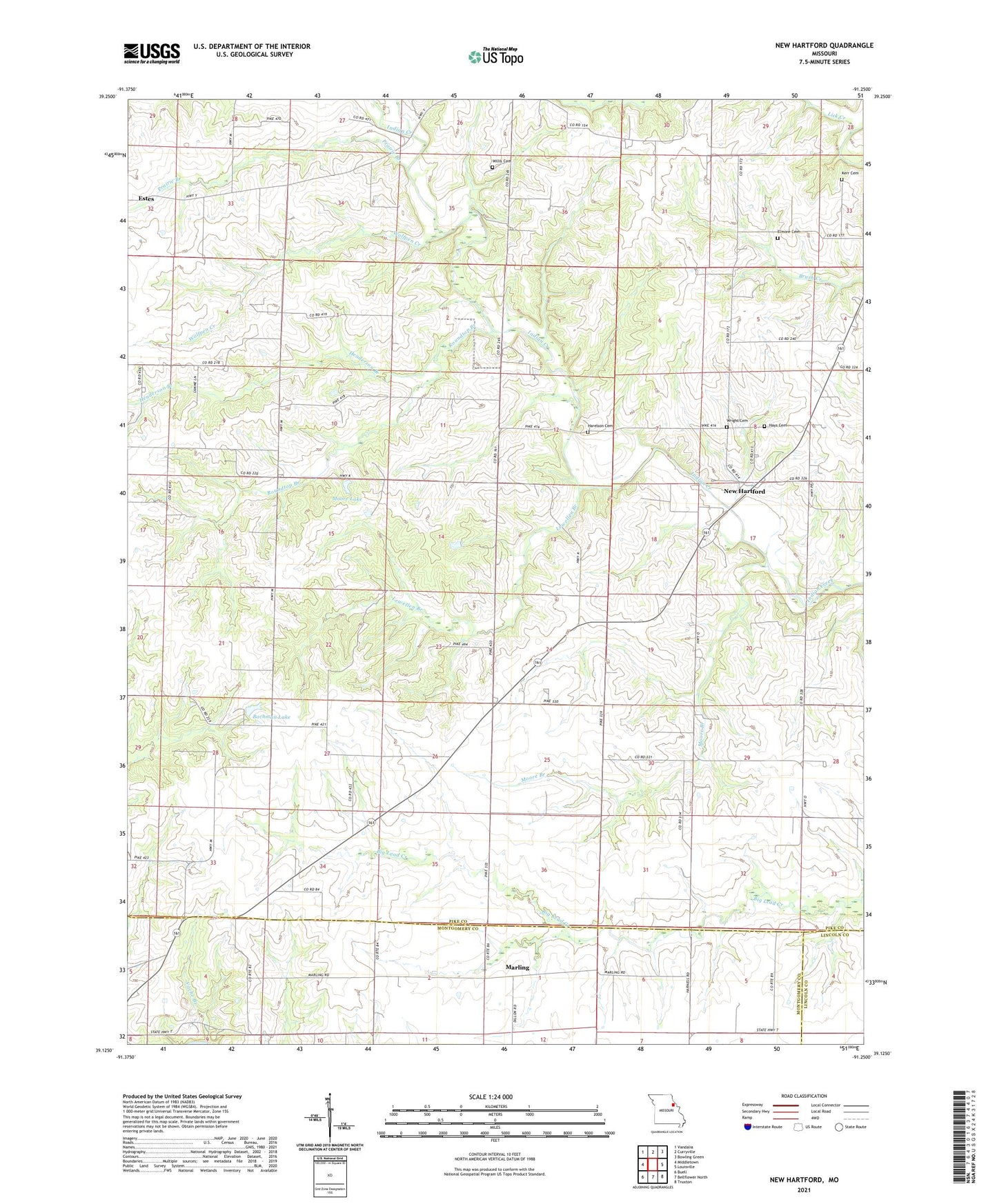
2021 topographic map quadrangle New Hartford in the state of Missouri. Scale: 1:24000. Based on the newly updated USGS 7.5' US Topo map series, this map is in the following counties: Pike, Montgomery, Lincoln. The map contains contour data, water features, and other items you are used to seeing on USGS maps, but also has updated roads and other features. This is the next generation of topographic maps. Printed on high-quality waterproof paper with UV fade-resistant inks.
Quads adjacent to this one:
West: Middletown
Northwest: Vandalia
North: Curryville
Northeast: Bowling Green
East: Louisville
Southeast: Truxton
South: Bellflower North
Southwest: Buell
Contains the following named places: Bachman Lake, Bachman Lake Dam, Central Grove Community Center, Central Grove School, Charles Moore Dam, Dunn School, Elmore Cemetery, Harelson Cemetery, Hays Cemetery, Henderson Branch, Hopke Church, Hopke School, Kerr Cemetery, Lewellen Branch, Lick Creek, Marling, Moore Branch, Moore Lake, New Hartford, Prairie Branch, Roundtop Branch, Siloam Church, Smyrna Church, Township of Hartford, Union School, Vache Branch, West Prairie Church, Willis Cemetery, Wolfpen Creek, Wright Cemetery, ZIP Code: 63359