
MyTopo
Nixa Missouri US Topo Map
Couldn't load pickup availability
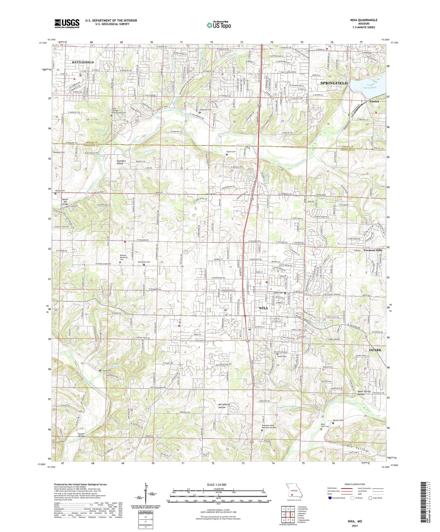
2021 topographic map quadrangle Nixa in the state of Missouri. Scale: 1:24000. Based on the newly updated USGS 7.5' US Topo map series, this map is in the following counties: Christian, Greene. The map contains contour data, water features, and other items you are used to seeing on USGS maps, but also has updated roads and other features. This is the next generation of topographic maps. Printed on high-quality waterproof paper with UV fade-resistant inks.
Quads adjacent to this one:
West: Republic
Northwest: Brookline
North: Springfield
Northeast: Galloway
East: Ozark
Southeast: Selmore
South: Highlandville
Southwest: Hurley
Contains the following named places: Avin Sink, Battlefield, Battlefield Fire Protection District Station 1, Battlefield Fire Protection District Station 2, Battlefield Fire Protection District Station 4, Battlefield Police Department, Bledsoe Memorial Cemetery, Blue Spring, Central Point School, Cherokee School, City of Battlefield, City of Fremont Hills, City of Nixa, Elk Valley, Farmer Branch, Frazier Bridge, Green Ridge School, Guin, Hartley School, Indian Spring, James Cemetery, Kissick, KWTO-FM (Springfield), Lake Springfield, Lake Springfield Dam, Lone Hill School, Manley Cemetery, Maple Grove School, McConnell Cemetery, McLean Cemetery, Needmore, Needmore Branch, Nelson Mill Bridge, Nixa, Nixa Fire Protection District Station 1, Nixa Fire Protection District Station 2/ District Headquarters, Nixa Fire Protection District Station 3, Nixa Police Department, Nixa Post Office, Nokes Cemetery, North View School, Patterson Cemetery, Payne Cemetery, Plainview School, Riverpark, Saunders Valley, Shady Acres Golf Course, Shamrock School, Sheltering Heights Camp, Spout Spring, Spout Spring Hollow, Springfield Fire Department Station 11, Township of Battlefield A, Township of Battlefield B, Township of Cherokee, Township of Clay, Township of East Clay A, Township of Garden Grove, Township of Northview, Township of Porter, Township of Rosedale, Township of Union Chapel, Township of Wilson C, Township of Wilson CW, Turkey Hollow, Union Chapel, Union Hill Church, Walnut Hill Church, Ward Branch, Wasson Spring, Willow Pond, Workman Branch, Young Cemetery, Young Spring, ZIP Codes: 65714, 65810


