MyTopo
Galloway Missouri US Topo Map
Couldn't load pickup availability
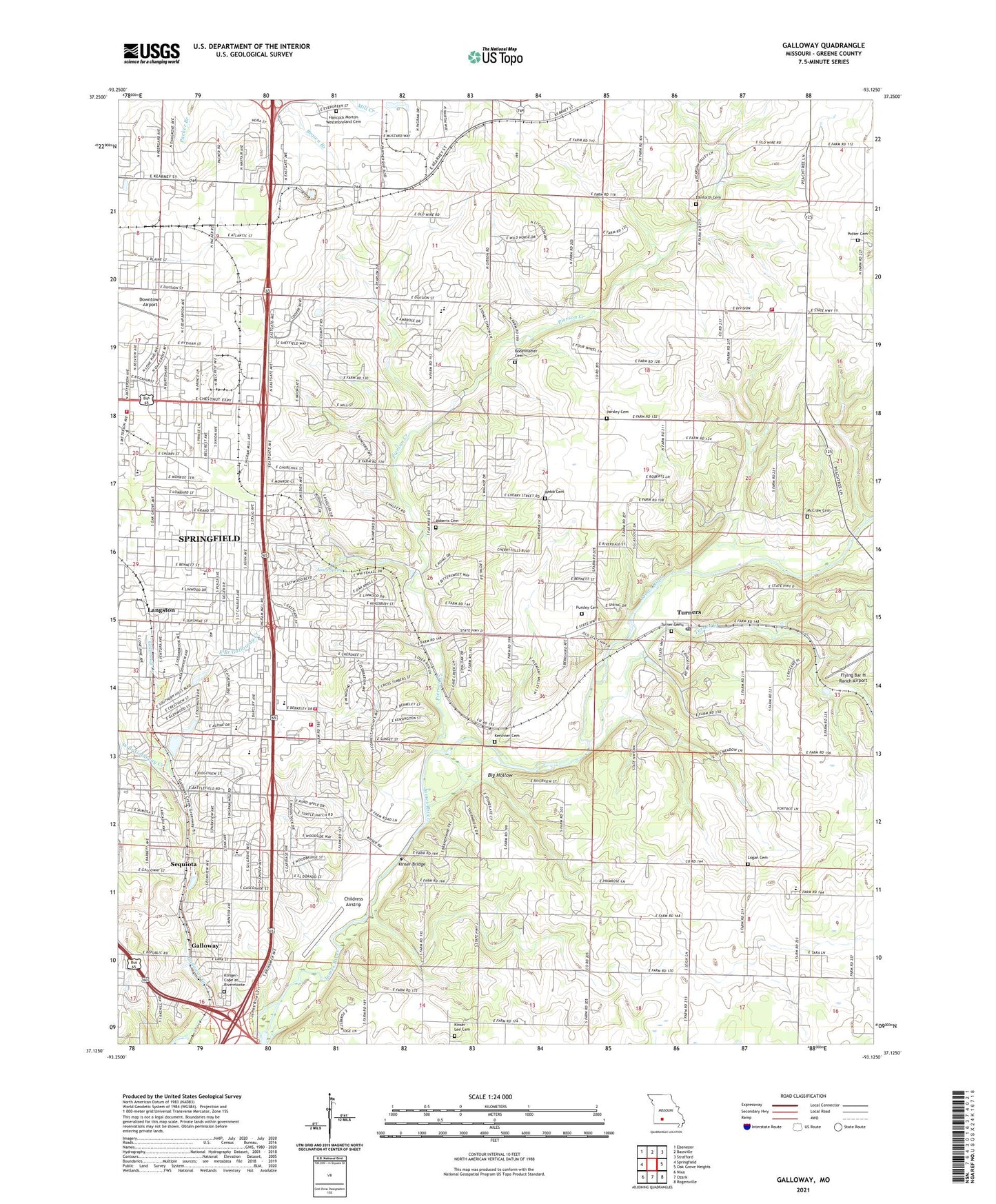
2021 topographic map quadrangle Galloway in the state of Missouri. Scale: 1:24000. Based on the newly updated USGS 7.5' US Topo map series, this map is in the following counties: Greene. The map contains contour data, water features, and other items you are used to seeing on USGS maps, but also has updated roads and other features. This is the next generation of topographic maps. Printed on high-quality waterproof paper with UV fade-resistant inks.
Quads adjacent to this one:
West: Springfield
Northwest: Ebenezer
North: Bassville
Northeast: Strafford
East: Oak Grove Heights
Southeast: Rogersville
South: Ozark
Southwest: Nixa
This map covers the same area as the classic USGS quad with code o37093b2.
Contains the following named places: Big Hollow, Blackman School, Bodenhamer Cemetery, Childress Airstrip, Crescent Church, Danforth Church, Downtown Airport, Dublin, East Branch Galloway Creek, Eastland Church, Expansion, Flying Bar H Ranch Airport, Ford Lake, Ford Lake Dam, Galloway, Galloway Creek, Glendale High School, Glenwood Park, Hickory Hills Country Club, Hickory Hills School, Immanuel Church, John Q McLean Lee and Hammons Lake Number 3 Dam, Jones Branch, Jones Spring, Kershner Cemetery, Kinser Bridge, Kinser Chapel, Kinser School, Klinger-Cope at Rivermonte, KTTS-FM (Springfield), Langston, Lee Cemetery, Leo Journagan Lake Dam, Logan - Rogersville Fire Protection District Station 2, Logan Cemetery, Logan School, McCraw Cemetery, Missouri Department of Conservation Forestry Southwest Regional Field Fire Office Springfield, Missouri State Highway Patrol Troop D, Mount Pisgah Church, Mount Pisgah School, Mumford, Mustard Branch, Nathalia, Oak Grove School, Oakland Church, Oakland School, Parsley Cemetery, Pershing School, Pierson Creek, Pittman School, Pleasant Valley School, Plummer School, Potter Cemetery, Provision, Pursley Cemetery, Roberts Cemetery, Sequiota, Sequiota Park, Sequiota School, Sequiota Spring Branch, Shady Dell School, Springfield Conservation Nature Center, Springfield Fire Department Station 12, Springfield Fire Department Station 3, Strafford Fire Protection District Station 2, Sunshine Church, Township of Campbell Number 1, Township of Clay C, Township of North Campbell Number 1, Turner Creek, Turners, Turners Post Office, Vans Heliport, Webb Cemetery, West Branch Galloway Creek, Westmoreland Cemetery, Wilder School, ZIP Code: 65809