MyTopo
Oak Ridge Missouri US Topo Map
Couldn't load pickup availability
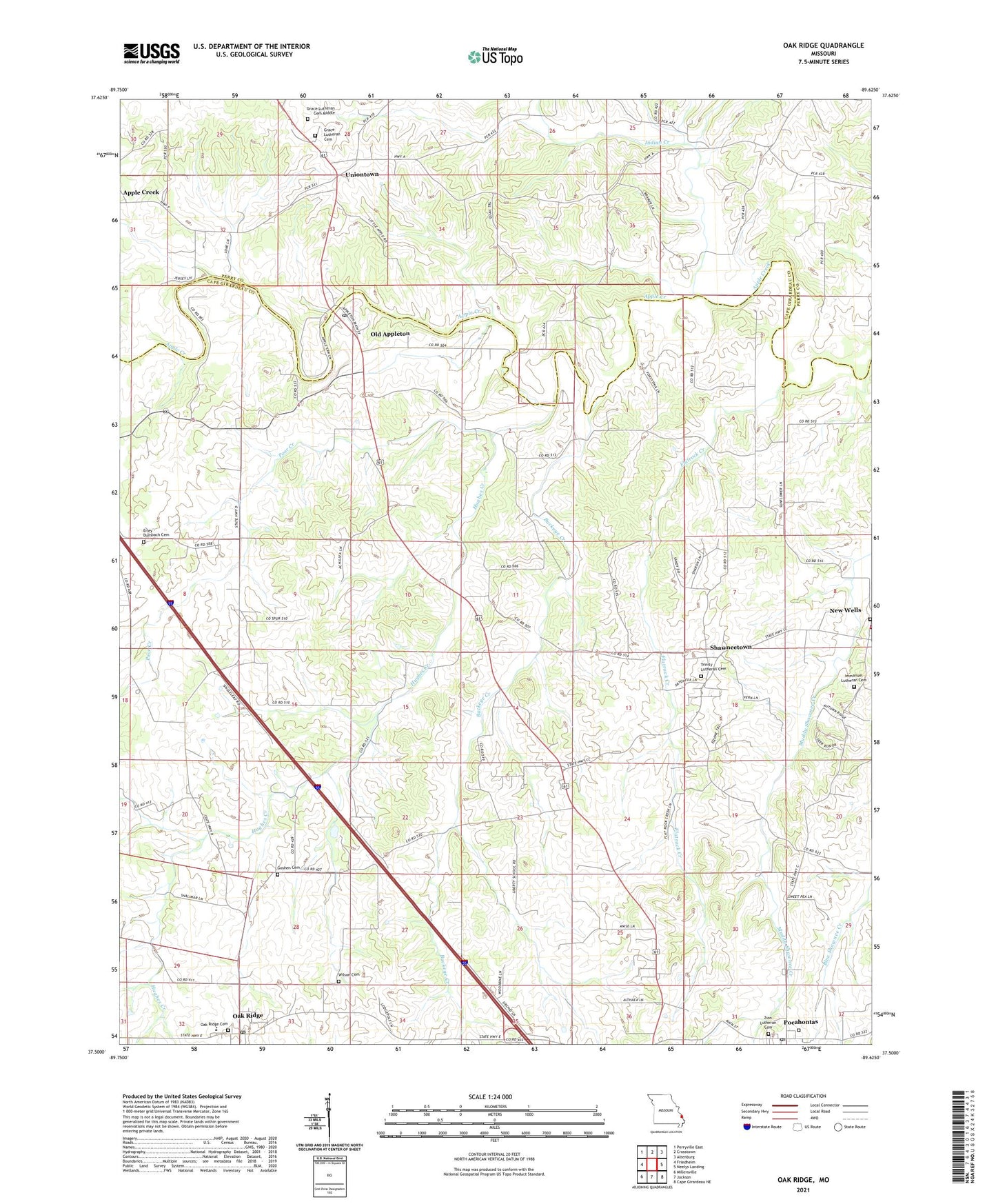
2021 topographic map quadrangle Oak Ridge in the state of Missouri. Scale: 1:24000. Based on the newly updated USGS 7.5' US Topo map series, this map is in the following counties: Cape Girardeau, Perry. The map contains contour data, water features, and other items you are used to seeing on USGS maps, but also has updated roads and other features. This is the next generation of topographic maps. Printed on high-quality waterproof paper with UV fade-resistant inks.
Quads adjacent to this one:
West: Friedheim
Northwest: Perryville East
North: Crosstown
Northeast: Altenburg
East: Neelys Landing
Southeast: Cape Girardeau NE
South: Jackson
Southwest: Millersville
Contains the following named places: Apple Creek, Apple Creek Church, Apple Creek Valley School, Appleton School, Buckeye Creek, Buckeye School, Concord, Flatrock Creek, Fruitland Area Fire Protection District Station 2, Goshen Church, Goshen School, Grace Lutheran Cemetery, Hughes Creek, Immanuel Lutheran Cemetery Old, Indian Creek, Liberty School, Liberty School Number 1, Oak Ridge, Oak Ridge Cemetery, Oak Ridge Post Office, Old Appleton, Old Appleton Post Office, Pocahontas, Pocahontas Post Office, Poor Creek, Shawneetown, Shawneetown Census Designated Place, Town of Old Appleton, Town of Pocahontas, Uniontown, Uniontown School, Zion Church, ZIP Codes: 63769, 63770, 63783