MyTopo
Crosstown Missouri US Topo Map
Couldn't load pickup availability
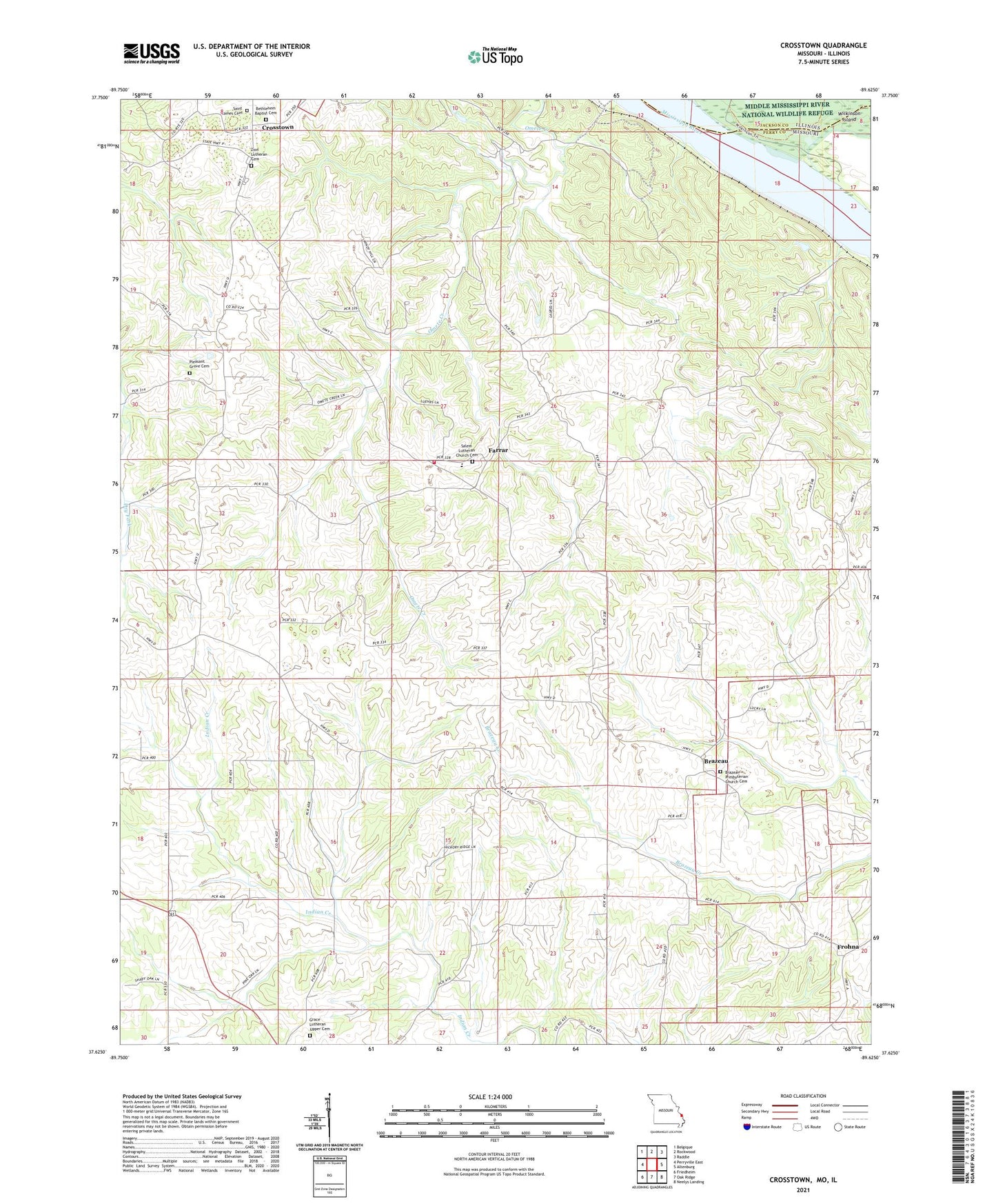
2021 topographic map quadrangle Crosstown in the states of Missouri, Illinois. Scale: 1:24000. Based on the newly updated USGS 7.5' US Topo map series, this map is in the following counties: Perry, Jackson. The map contains contour data, water features, and other items you are used to seeing on USGS maps, but also has updated roads and other features. This is the next generation of topographic maps. Printed on high-quality waterproof paper with UV fade-resistant inks.
Quads adjacent to this one:
West: Perryville East
Northwest: Belgique
North: Rockwood
Northeast: Raddle
East: Altenburg
Southeast: Neelys Landing
South: Oak Ridge
Southwest: Friedheim
This map covers the same area as the classic USGS quad with code o37089f6.
Contains the following named places: Brazeau, Brazeau Presbyterian Church, Brazeau Presbyterian Church Cemetery, Crosstown, East Perry County Rural Fire Protection Association Station 2, Eureka, Eureka School, Farrar, Fiehler School, Hager School, Pleasant Grove Church, Red Rock, Salem Lutheran Church Cemetery, Schalls School, Swan School, Township of Salem, Township of Union, Trickey School, Upper Wilkinson Landing, ZIP Codes: 63746, 63748