MyTopo
Perryville East Missouri US Topo Map
Couldn't load pickup availability
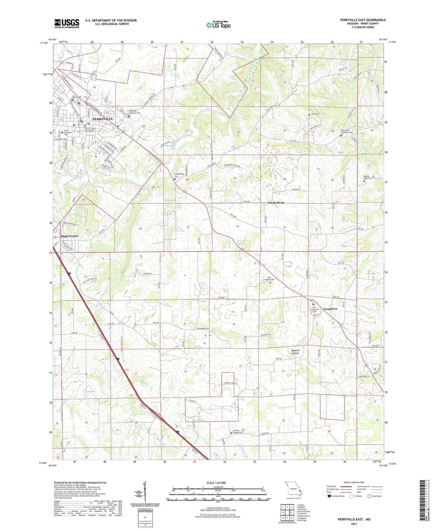
2021 topographic map quadrangle Perryville East in the state of Missouri. Scale: 1:24000. Based on the newly updated USGS 7.5' US Topo map series, this map is in the following counties: Perry. The map contains contour data, water features, and other items you are used to seeing on USGS maps, but also has updated roads and other features. This is the next generation of topographic maps. Printed on high-quality waterproof paper with UV fade-resistant inks.
Quads adjacent to this one:
West: Perryville West
Northwest: Lithium
North: Belgique
Northeast: Rockwood
East: Crosstown
Southeast: Oak Ridge
South: Friedheim
Southwest: Sedgewickville
This map covers the same area as the classic USGS quad with code o37089f7.
Contains the following named places: Abernathy School, Baptist Shed Cemetery, Bedwell Hollow, Calvary Church, Cashion School, Dry Run Branch, Duggins Mill, Duggins School, Friedenberg, Friedenberg Cemetery, Holy Cross Lutheran Cemetery, Home Cemetery, Horn Cemetery, Immanuel Lutheran Cemetery, Killian School, Longtown, Luthers Chapel Cemetery, Perry County, Perry County Fire Protection Association Station 1, Perry County Memorial Hospital, Perry County Sheriff's Office, Perry Plaza Shopping Center, Perryville, Perryville Fire Department Station 1, Perryville Fire Department Station 2, Perryville Police Department, Perryville Post Office, Rock Springs School, Saint Boniface Cemetery, Saint Boniface Church, Saint Vincent High School, Schawanes Springs Branch, Shakertowne, Shakertowne Census Designated Place, Town of Longtown, Township of Central, Township of Cinque Hommes, Willow Pond, York Chapel, Zion Lutheran Cemetery