MyTopo
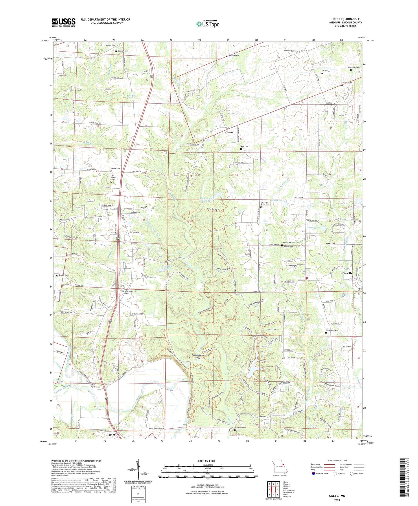
Okete Missouri US Topo Map
Couldn't load pickup availability
2021 topographic map quadrangle Okete in the state of Missouri. Scale: 1:24000. Based on the newly updated USGS 7.5' US Topo map series, this map is in the following counties: Lincoln. The map contains contour data, water features, and other items you are used to seeing on USGS maps, but also has updated roads and other features. This is the next generation of topographic maps. Printed on high-quality waterproof paper with UV fade-resistant inks.
Quads adjacent to this one:
West: Silex
Northwest: Eolia
North: Auburn
Northeast: Elsberry
East: Luckett Ridge
Southeast: Maryknoll
South: Troy
Southwest: Warrenton NE
Contains the following named places: Alexander Cemetery, Alexandria Church, Bailey Branch, Bricker Cemetery, Brussells, Camp Avery, Camp Cuivre, Camp Derricote, Camp Frenchmans Bluff, Camp Sherwood Forest, Camp Tuckaho, Carter Hall School, Christofferson Lake Dam, Cochran Cemetery, Cuivre Heights, Cuivre River State Park, David Kessler Memorial State Wildlife Area, Davis Cemetery, Dodson Cemetery, Dowell School, Downing Cemetery, Draper Branch, Dry Branch, Emert Lake, Emert Lake Dam, First United Church, Frenchmans Bluff, Girl Scout Lake, Girl Scout Lake Dam, Girl Scouts Dam, Gladney Cemetery, Hamilton Cemetery, Harmony Grove Cemetery, Harmony Grove School, Hill School, Holiness Church, Hopkins Cemetery, Indian Nest Hollow, Lake Lincoln, Lake Lincoln Dam, Lincoln County, Lincoln County Fire Protection District 1 Station 3, Lincoln County Fire Protection District 1 Station 4, Morris Cemetery, Morris School, North Fork Cuivre River, Okete, Old Alexandria Cemetery, Old Alexandria Church, Old Morris Cemetery, Porter Slough, Reid Cemetery, Reid School, Riggs Ford, Shady Eighty Ranch Lake, Shady Eighty Ranch Lake Dam, Sherwood Forest, Spring Creek, Sugar Creek Church, Suter Lake, Suter Lake Dam, Thornhill Cemetery, Township of Snow Hill, Welker Lake, West Fork Cuivre River, Whiteside Cemetery, ZIP Code: 63379