MyTopo
Warrenton NE Missouri US Topo Map
Couldn't load pickup availability
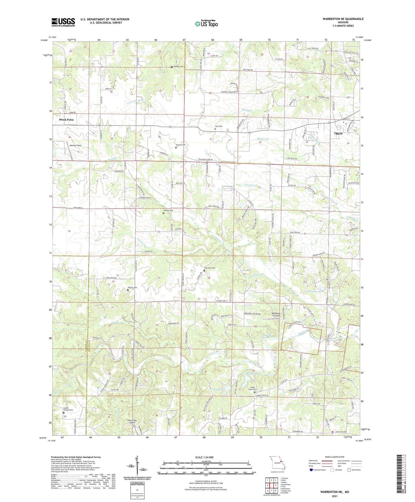
2021 topographic map quadrangle Warrenton NE in the state of Missouri. Scale: 1:24000. Based on the newly updated USGS 7.5' US Topo map series, this map is in the following counties: Lincoln, Warren. The map contains contour data, water features, and other items you are used to seeing on USGS maps, but also has updated roads and other features. This is the next generation of topographic maps. Printed on high-quality waterproof paper with UV fade-resistant inks.
Quads adjacent to this one:
West: Hawk Point
Northwest: Truxton
North: Silex
Northeast: Okete
East: Troy
Southeast: Foristell
South: Wright City
Southwest: Warrenton
This map covers the same area as the classic USGS quad with code o38091h1.
Contains the following named places: Becker Lake, Becker Lake Dam, Big Creek Community Center, Boone Elementary School, Brown School, Camp Char-ren, Camp Ground Cemetery, Camp Ground Church, Camp Ground School, Casmer Branch, Casselman Branch, Coon Creek, Crystal Lake, Crystal Lake Dam, Douglas Cemetery, Dry Creek, East Cemetery, Genteman Lake, Genteman Lake Dam, Hammond School, Harvey Cemetery, Hedemen Springs, Hickory Lick Creek, Indian Camp Cemetery, Koelling School, Lincoln Elementary School, Linns Mills, Meister Branch, Mononame 345 Dam, Monroe Field, Moore School, Old Davis Cemetery, Perkins School, Schroer School, Schupmann Lake, Schupmann Lake Dam, Shelton Cemetery, Shelton School, Slavens Cemetery, Township of Hawk Point, Woodlake, Woodlake Dam, Woodland Airstrip, Wright City Fire Protection District Station 3, Zoar Church