MyTopo
Ozark Springs Missouri US Topo Map
Couldn't load pickup availability
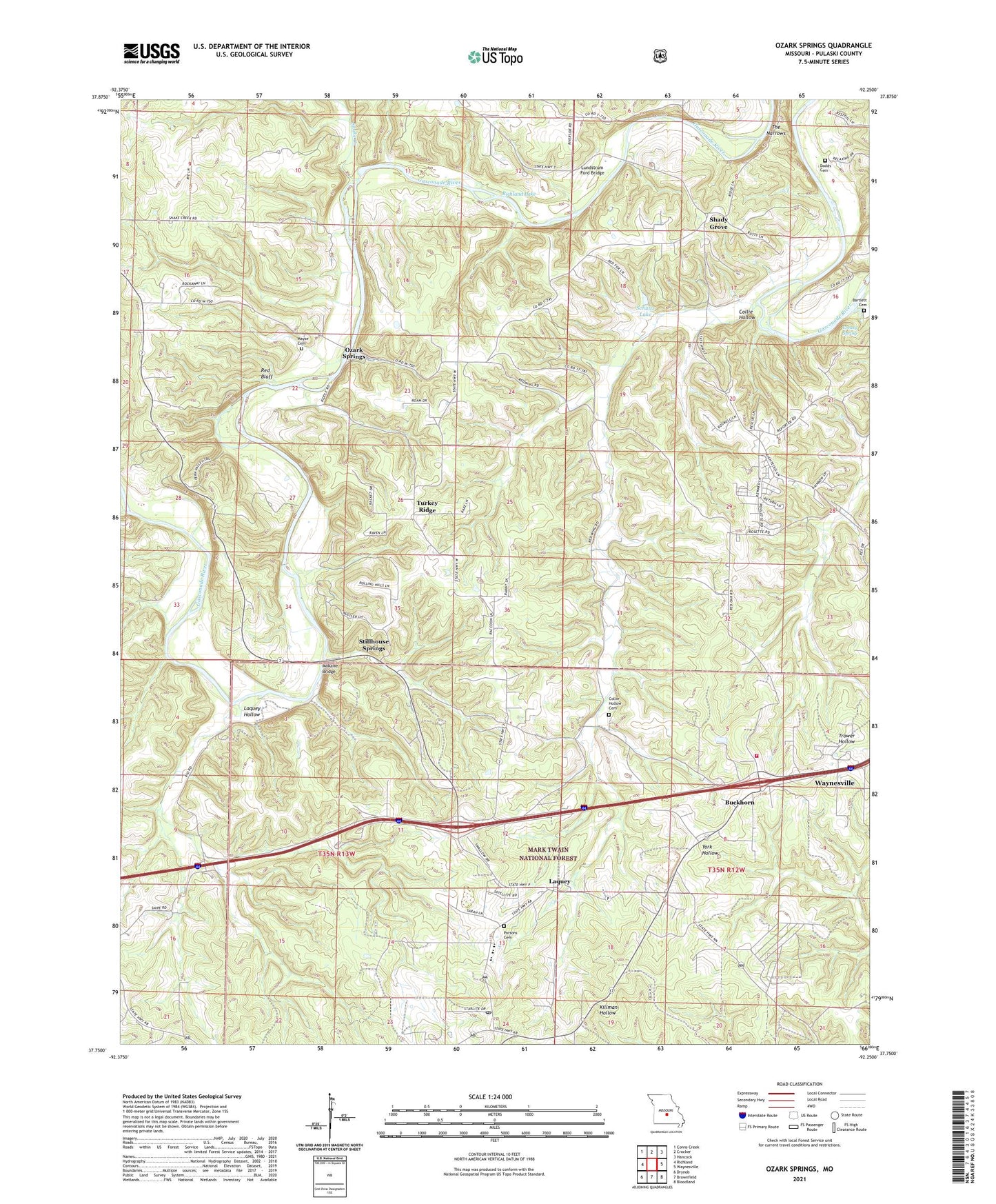
2021 topographic map quadrangle Ozark Springs in the state of Missouri. Scale: 1:24000. Based on the newly updated USGS 7.5' US Topo map series, this map is in the following counties: Pulaski. The map contains contour data, water features, and other items you are used to seeing on USGS maps, but also has updated roads and other features. This is the next generation of topographic maps. Printed on high-quality waterproof paper with UV fade-resistant inks.
Quads adjacent to this one:
West: Richland
Northwest: Conns Creek
North: Crocker
Northeast: Hancock
East: Waynesville
Southeast: Bloodland
South: Brownfield
Southwest: Drynob
Contains the following named places: Bartlett Cemetery, Berean Church, Buckhorn, Buzzard Roost School, Center Point Church, Collie Hollow, Collie Hollow Cemetery, Creasy Spring, Debruin, Deer Lick Church, Dodds Cemetery, Evans Place, Friendship Church, Gasconade Heights, Hickory Grove School, Hilton School, Idumea Church, Kieseweltter Resort, Laquey, Laquey Hollow, Laquey Post Office, Laquey School, Lundstrum Ford Bridge, Mayse Cemetery, Mokane Bridge, Moro School, Ozark Springs, Parsons Cemetery, Paw Paw Lodge, Pippin Place, Pleasant Grove School, Red Bluff, Richland Lake, Schultz Lake, Schultz Lake Dam, Shady Grove, Snake Creek, Still House Resort, Stillhouse Springs, The Narrows, Township of Liberty, Trower School, Turkey Ridge, Turkey Ridge School, Waynesville Rural Fire Protection District Station 2, ZIP Code: 65583