MyTopo
Conns Creek Missouri US Topo Map
Couldn't load pickup availability
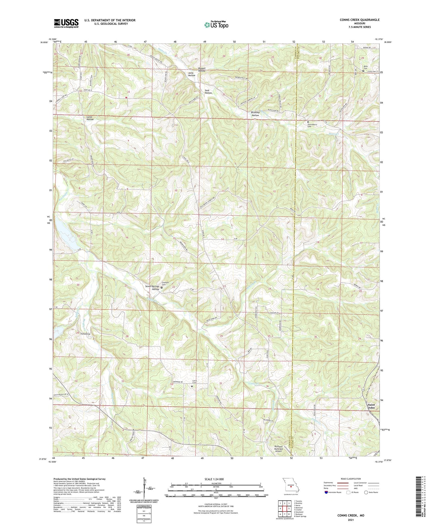
2021 topographic map quadrangle Conns Creek in the state of Missouri. Scale: 1:24000. Based on the newly updated USGS 7.5' US Topo map series, this map is in the following counties: Camden, Pulaski. The map contains contour data, water features, and other items you are used to seeing on USGS maps, but also has updated roads and other features. This is the next generation of topographic maps. Printed on high-quality waterproof paper with UV fade-resistant inks.
Quads adjacent to this one:
West: Montreal
Northwest: Toronto
North: Brumley
Northeast: Iberia
East: Crocker
Southeast: Ozark Springs
South: Richland
Southwest: Stoutland
This map covers the same area as the classic USGS quad with code o37092h4.
Contains the following named places: Atkisson Lake Dam, Beulah Church, Brumley Hollow, Chalfant Cemetery, Conns Creek, Deberry Creek, Elm Grove Church, Elm Grove School, Fairview School, Gibson School, Glaize, Hawkeye School, Julia Hollow, Lewis Cemetery, Lucas Hollow, Miles Cemetery, Montrose Church, Mountview Church, Murphy Creek, Oak Grove School, Oak Law School, Oak View School, O'Halloran School, Richland Municipal Airport, Russell Hollow, Saint John, Sellars Creek, Seven Springs Hollow, Sock Hollow, Stoops Branch, Thornsberry Cemetery, Tri - County Fire and Rescue Association Station 2, Zaring