MyTopo
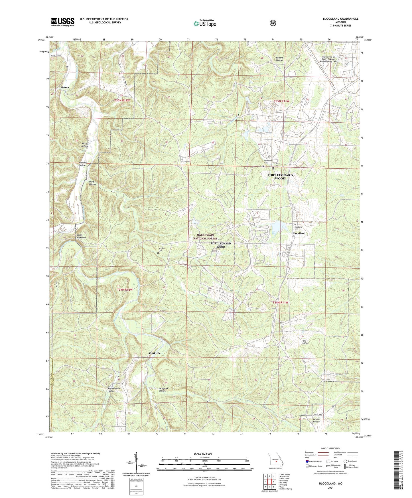
Bloodland Missouri US Topo Map
Couldn't load pickup availability
Also explore the Bloodland Forest Service Topo of this same quad for updated USFS data
2021 topographic map quadrangle Bloodland in the state of Missouri. Scale: 1:24000. Based on the newly updated USGS 7.5' US Topo map series, this map is in the following counties: Pulaski, Laclede. The map contains contour data, water features, and other items you are used to seeing on USGS maps, but also has updated roads and other features. This is the next generation of topographic maps. Printed on high-quality waterproof paper with UV fade-resistant inks.
Quads adjacent to this one:
West: Brownfield
Northwest: Ozark Springs
North: Waynesville
Northeast: Devils Elbow
East: Big Piney
Southeast: Slabtown Spring
South: Roby
Southwest: Winnipeg
This map covers the same area as the classic USGS quad with code o37092f2.
Contains the following named places: Bailey, Berry Hollow, Bloodland, Bloodland Cemetery, Bloodland Quad Number 1 Dam, Bloodland Quad Number 2 Dam, Bloodland Quad Number 4 Dam, Clark Cemetery, Cookville, Devils Backbone, Dudas Ford, Dundas School, Elliot Branch, Fidelis Horse Ranch, Flatrock Hollow, Fort Leonard Wood, Friendship Cemetery, Friendship Church, Hanna, Hurd Hollow, Lone Star School Number One, McCann Historic Cemetery, Musgrave Hollow, Mush Paddle Hollow, Number 834 Dam, Number 835 Dam, Palace Church, Palace School, Penns Pond Dam, Saint Annie Church, Township of Roubidoux, Waynesville-St Robert Regional Airport Forney Field, ZIP Code: 65473