MyTopo
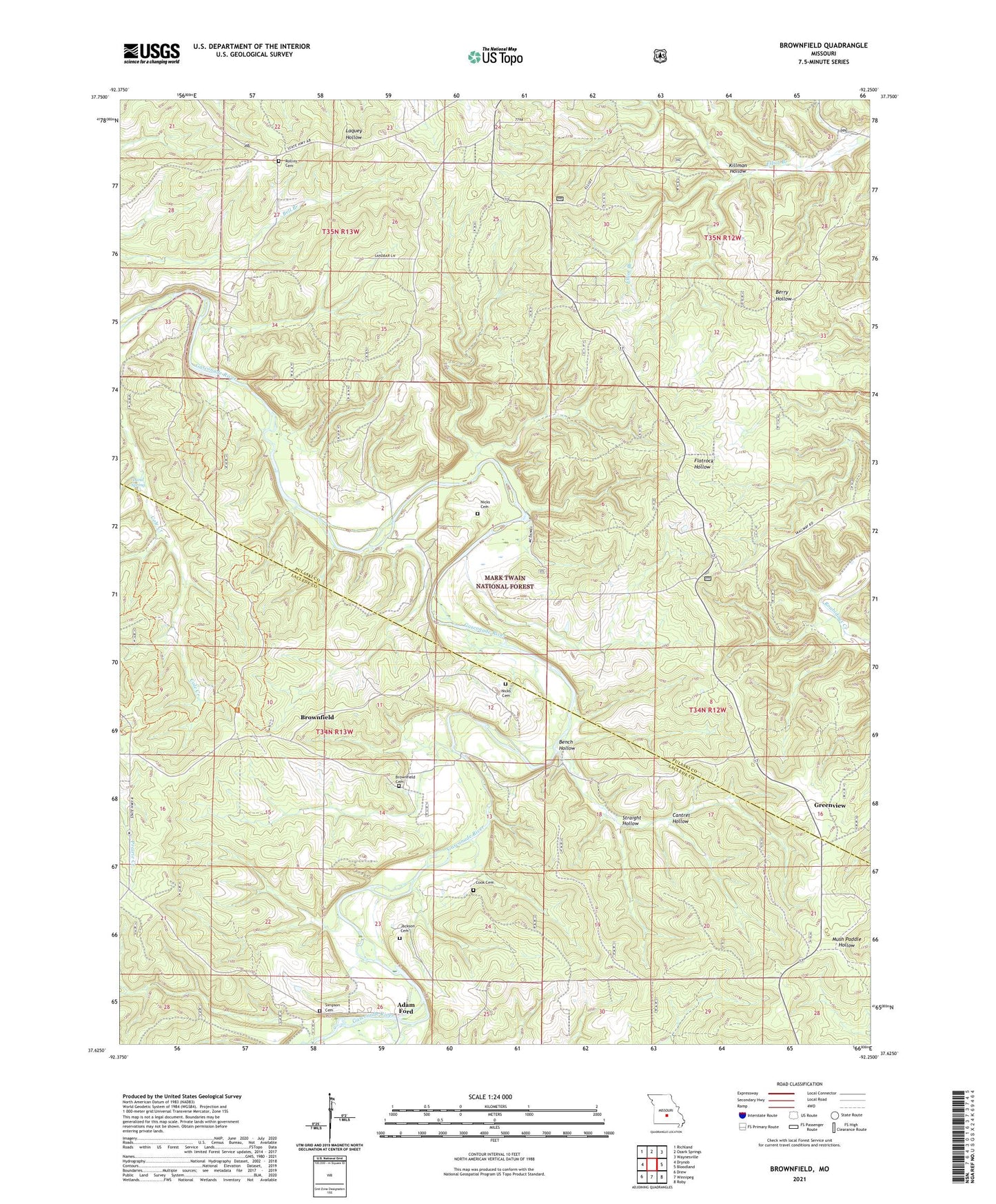
Brownfield Missouri US Topo Map
Couldn't load pickup availability
Also explore the Brownfield Forest Service Topo of this same quad for updated USFS data
2021 topographic map quadrangle Brownfield in the state of Missouri. Scale: 1:24000. Based on the newly updated USGS 7.5' US Topo map series, this map is in the following counties: Pulaski, Laclede. The map contains contour data, water features, and other items you are used to seeing on USGS maps, but also has updated roads and other features. This is the next generation of topographic maps. Printed on high-quality waterproof paper with UV fade-resistant inks.
Quads adjacent to this one:
West: Drynob
Northwest: Richland
North: Ozark Springs
Northeast: Waynesville
East: Bloodland
Southeast: Roby
South: Winnipeg
Southwest: Drew
This map covers the same area as the classic USGS quad with code o37092f3.
Contains the following named places: Adam Ford, Belle Fonte School, Bellefonte, Bench Hollow, Brownfield, Brownfield Cemetery, Brownfield Missionary Church, Brownfield School, Cantrel Hollow, Cave Spring School, Cole Creek Horse Trail, Cook Cemetery, Fairview Church, Fairview Lookout Tower, Fairview School, Fyan, Greenview, Jackson Cemetery, Killman Hollow, Land Spring, Nelson Creek, Nelson School, Nicks Cemetery, Prospect School, Rollins Cemetery, Simpson Cemetery, Simpson School, Straight Hollow, ZIP Code: 65534