MyTopo
Phillipsburg Missouri US Topo Map
Couldn't load pickup availability
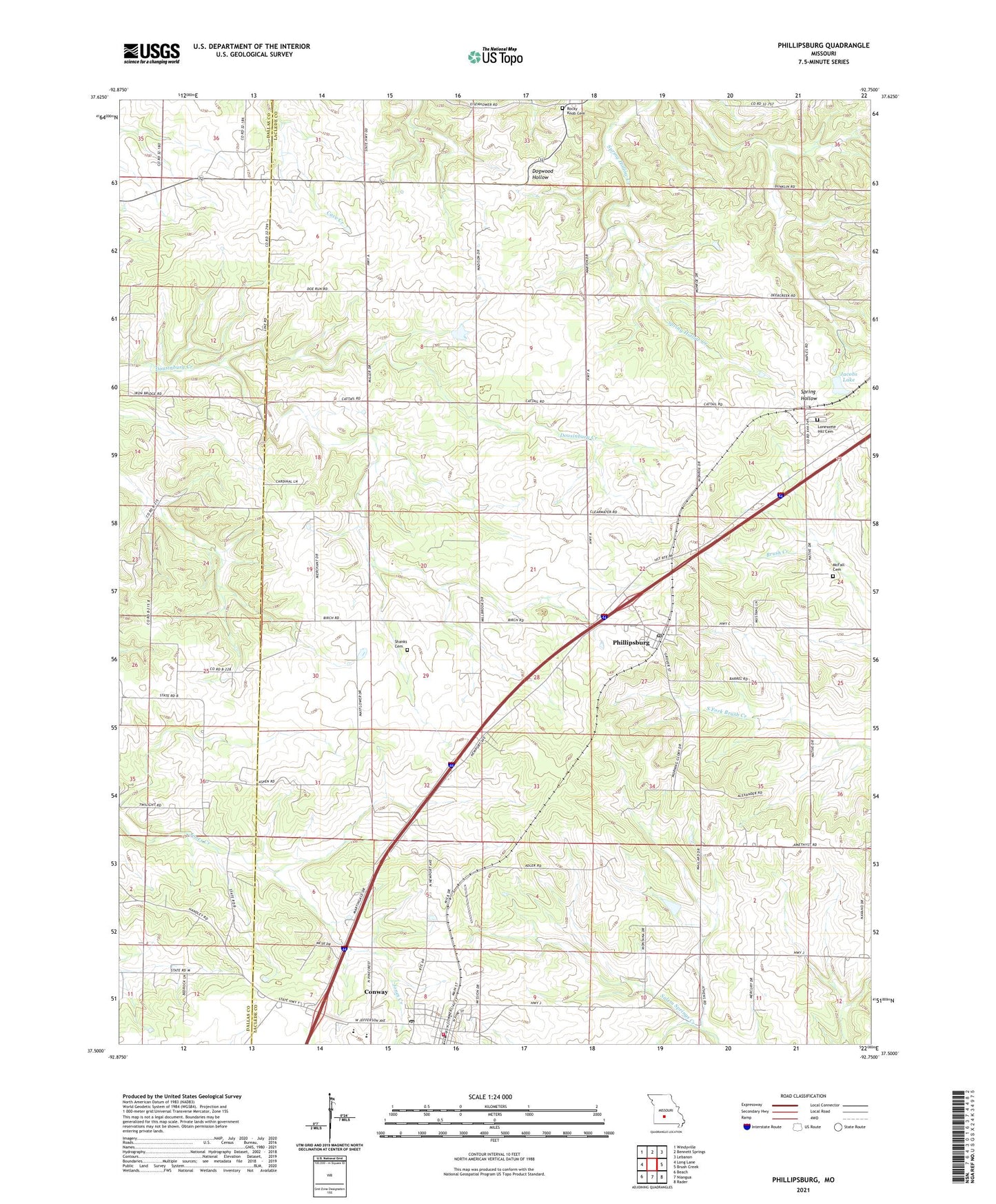
2021 topographic map quadrangle Phillipsburg in the state of Missouri. Scale: 1:24000. Based on the newly updated USGS 7.5' US Topo map series, this map is in the following counties: Laclede, Dallas. The map contains contour data, water features, and other items you are used to seeing on USGS maps, but also has updated roads and other features. This is the next generation of topographic maps. Printed on high-quality waterproof paper with UV fade-resistant inks.
Quads adjacent to this one:
West: Long Lane
Northwest: Windyville
North: Bennett Springs
Northeast: Lebanon
East: Brush Creek
Southeast: Rader
South: Niangua
Southwest: Beach
Contains the following named places: Brittain, City of Conway, Conway, Conway Post Office, Conway Volunteer Fire Department, Flib Field, Huben, Jacobs Lake, Lees Summit Church, Lonesome Hill Cemetery, Lonesome Hill School, McFall Cemetery, Mount Zion Church, Mount Zion School, New Hope Church, Oak Summit School, Phillipsburg, Phillipsburg Church, Phillipsburg Post Office, Porto Farms Lake Dam, Rocky Knob Cemetery, Salem School, Shanks Cemetery, South View School, Stony Point School, Township of Phillipsburg, Twilight Church, Twilight School, Union Hill School, Village of Phillipsburg, ZIP Code: 65722