MyTopo
Long Lane Missouri US Topo Map
Couldn't load pickup availability
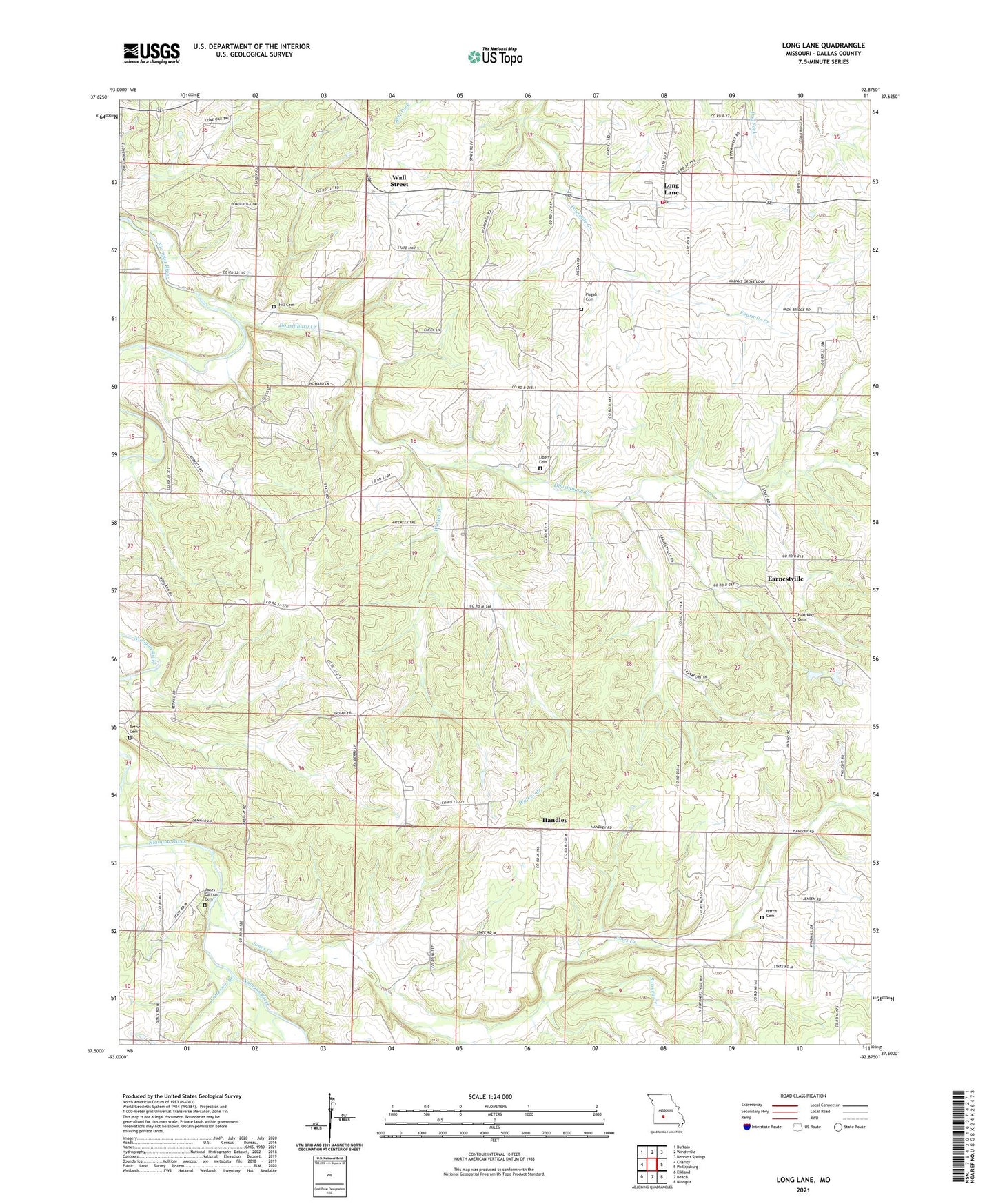
2021 topographic map quadrangle Long Lane in the state of Missouri. Scale: 1:24000. Based on the newly updated USGS 7.5' US Topo map series, this map is in the following counties: Dallas. The map contains contour data, water features, and other items you are used to seeing on USGS maps, but also has updated roads and other features. This is the next generation of topographic maps. Printed on high-quality waterproof paper with UV fade-resistant inks.
Quads adjacent to this one:
West: Charity
Northwest: Buffalo
North: Windyville
Northeast: Bennett Springs
East: Phillipsburg
Southeast: Niangua
South: Beach
Southwest: Elkland
This map covers the same area as the classic USGS quad with code o37092e8.
Contains the following named places: Bethel Cemetery, Bethel Church, Brushy Ridge School, Cheek School, Cloverdale Church, Cloverdale School, Dousinbury Creek, Earnestville, Gann School, Gaunt Ford, Green Mountain Church, Handley, Handley School, Harmony Cemetery, Harmony Church, Harris Cemetery, Hill Cemetery, Holiness Church, Independence School, Jones Branch, Jones Creek, Jones-Cannon Cemetery, Latimore School, Liberty Cemetery, Liberty Church, Limekiln Ford, Long Lane, Long Lane Post Office, Long Lane Volunteer Fire Department, New Prospect Church, Patterson Branch, Pattersonville School, Pisgah Cemetery, Pisgah Church, Shady Grove, Shady Grove School, Starvey Creek, Thurman Lake Dam, Township of Washington, Township of Wilson, Walker Branch, Wall Street, Walnut Grove School, Washington School, ZIP Code: 65590