MyTopo
Saint Patrick Missouri US Topo Map
Couldn't load pickup availability
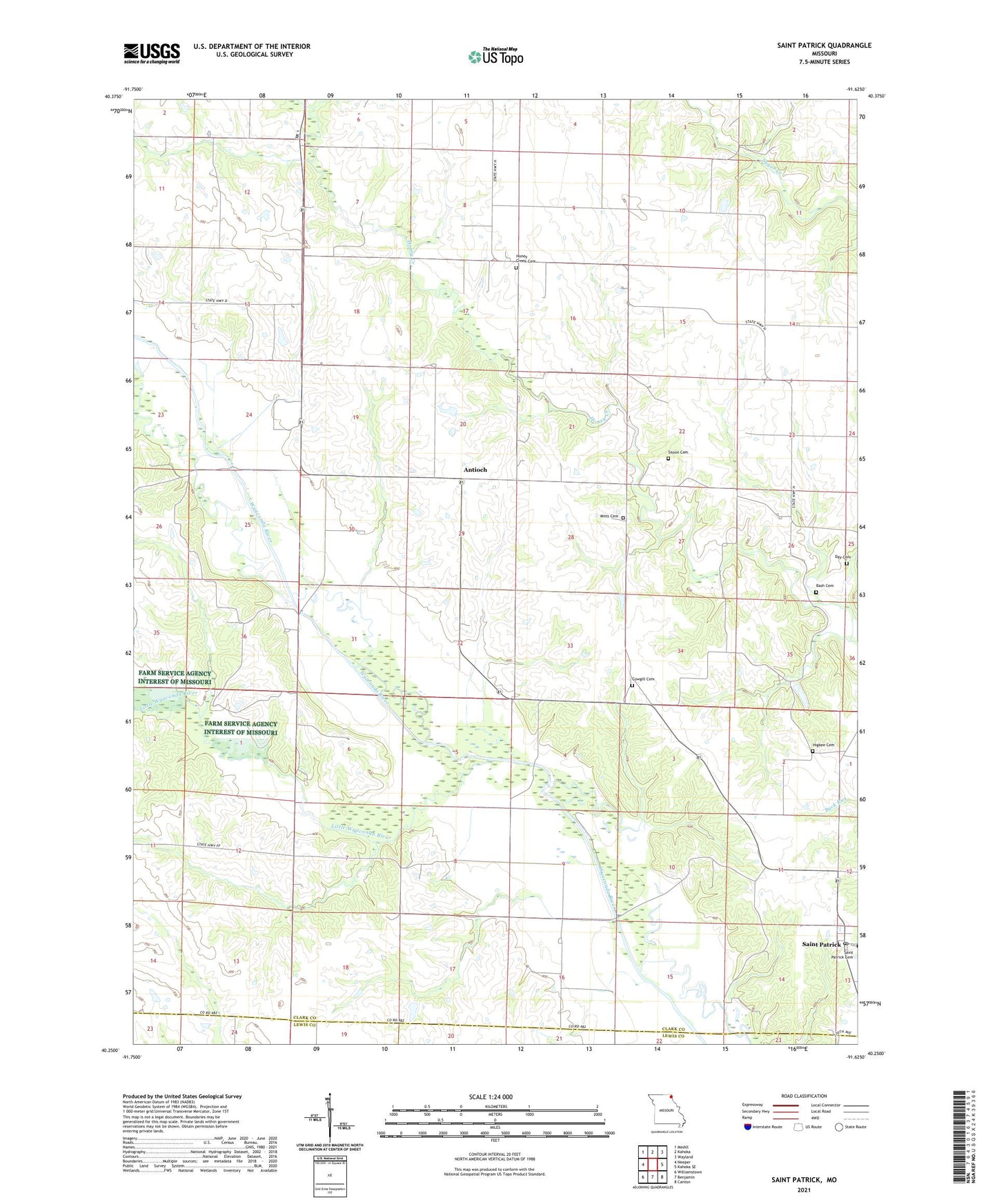
2021 topographic map quadrangle Saint Patrick in the state of Missouri. Scale: 1:24000. Based on the newly updated USGS 7.5' US Topo map series, this map is in the following counties: Clark, Lewis. The map contains contour data, water features, and other items you are used to seeing on USGS maps, but also has updated roads and other features. This is the next generation of topographic maps. Printed on high-quality waterproof paper with UV fade-resistant inks.
Quads adjacent to this one:
West: Neeper
Northwest: Medill
North: Kahoka
Northeast: Wayland
East: Kahoka SE
Southeast: Canton
South: Benjamin
Southwest: Williamstown
Contains the following named places: Antioch, Antioch School, Bash Cemetery, Buschling Lake Dam, Cedar Grove Church, Clark School, Cowgill Cemetery, Day Cemetery, Diamond School, Enterprise School, Gem Post Office, Gem School, Higbee Cemetery, Honey Creek Cemetery, Honey Creek Congregational Church, Little Wyaconda River, Mitts Cemetery, Pride of the West School, Rossi Lake Dam, Saint Patrick, Saint Patrick Post Office, Saint Patrick School, Sisson Cemetery, Sisson Chapel, Stone School, Township of Jackson, White School