MyTopo
Williamstown Missouri US Topo Map
Couldn't load pickup availability
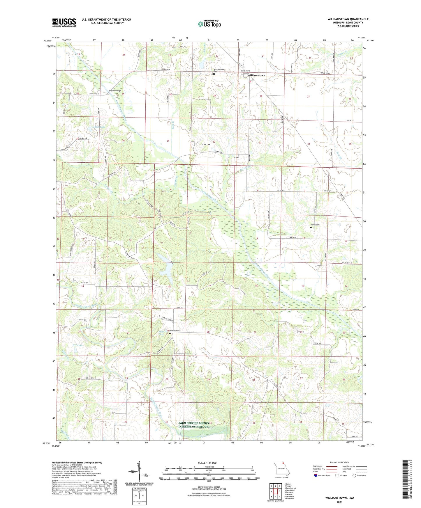
2021 topographic map quadrangle Williamstown in the state of Missouri. Scale: 1:24000. Based on the newly updated USGS 7.5' US Topo map series, this map is in the following counties: Lewis. The map contains contour data, water features, and other items you are used to seeing on USGS maps, but also has updated roads and other features. This is the next generation of topographic maps. Printed on high-quality waterproof paper with UV fade-resistant inks.
Quads adjacent to this one:
West: Deer Ridge
Northwest: Colony
North: Neeper
Northeast: Saint Patrick
East: Benjamin
Southeast: Monticello
South: Lewistown
Southwest: La Belle
This map covers the same area as the classic USGS quad with code o40091b7.
Contains the following named places: Bowls School, Buck Branch, Buck Branch School, Catfish Lake, Catfish Lake Dam, Cecil Cemetery, Cooper Branch, Deer Ridge Community Lake, Deer Ridge Community Lake Dam, Egypt, Forsee Branch, H T Lake, H T Lake Dam, Hilbert Branch, McLain Bridge, Midway, Midway Cemetery, Midway Chapel, Morris Cemetery, Morris School, Murphy Lake, Murphy Lake Dam, Old Channel North Fabius River, Providence Baptist Church, Reddish Branch, Reynolds School, Ronald Lay Lake, Ronald Lay Lake Dam, Stice Lake, Stice Lake Dam, Township of Reddish, Turpin School, Walker School, Williamstown, Williamstown Cemetery, Williamstown Census Designated Place, Williamstown Volunteer Fire Department, Wurtzburger Lake, Wurtzburger Lake Dam, ZIP Code: 63473