MyTopo
Wayland Missouri US Topo Map
Couldn't load pickup availability
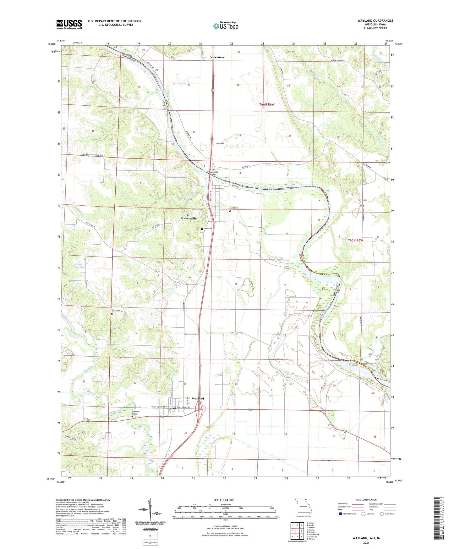
2021 topographic map quadrangle Wayland in the states of Missouri, Iowa. Scale: 1:24000. Based on the newly updated USGS 7.5' US Topo map series, this map is in the following counties: Clark, Lee. The map contains contour data, water features, and other items you are used to seeing on USGS maps, but also has updated roads and other features. This is the next generation of topographic maps. Printed on high-quality waterproof paper with UV fade-resistant inks.
Quads adjacent to this one:
West: Kahoka
Northwest: Croton
North: Argyle
Northeast: Nauvoo
East: Keokuk
Southeast: Warsaw
South: Kahoka SE
Southwest: Saint Patrick
This map covers the same area as the classic USGS quad with code o40091d5.
Contains the following named places: Amborn-Pagin Wildlife Area, Bartlett School, City of Wayland, Dinsmore School, Eagle School, Glades Lake Dam, Independent School, Jenkins School, Lawrence School, Melrose Church, Moores Mill, Oak Hill Cemetery, Oakland Cemetery, Saint Francisville, Saint Francisville Bridge, Saint Francisville Census Designated Place, Sand Cemetery, Sand Prairie Station, Sugar Creek, Township of Des Moines, Vincennes, Vincennes Post Office, Wayland, Wayland Bridge, Wayland Post Office, Wayland Volunteer Fire Protection Association, Weaver Branch, Winter-Wood Lake, Winter-Wood Lake Dam, Wolf Cemetery, ZIP Codes: 63430, 63472