MyTopo
Seymour Missouri US Topo Map
Couldn't load pickup availability
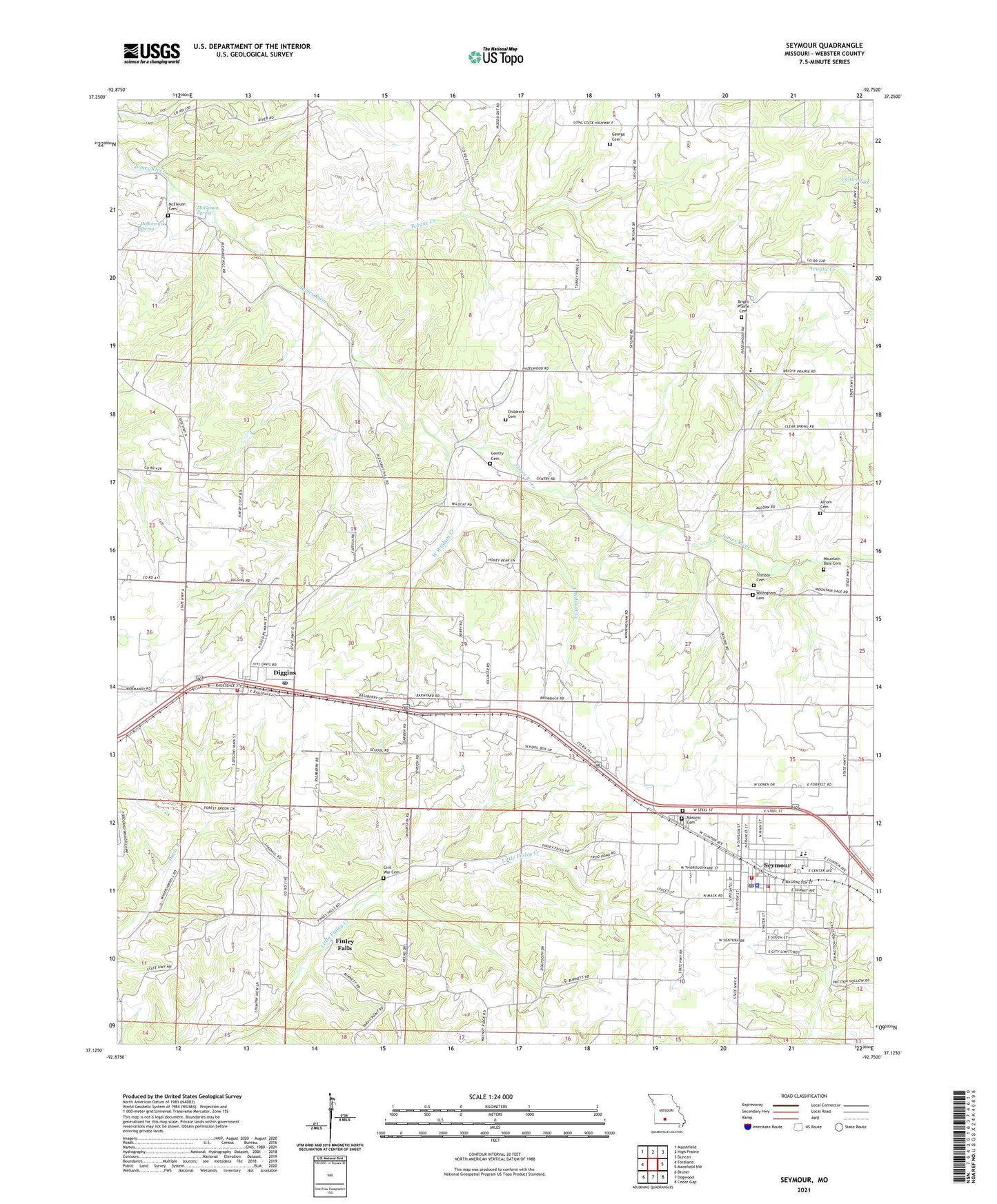
2021 topographic map quadrangle Seymour in the state of Missouri. Scale: 1:24000. Based on the newly updated USGS 7.5' US Topo map series, this map is in the following counties: Webster. The map contains contour data, water features, and other items you are used to seeing on USGS maps, but also has updated roads and other features. This is the next generation of topographic maps. Printed on high-quality waterproof paper with UV fade-resistant inks.
Quads adjacent to this one:
West: Fordland
Northwest: Marshfield
North: High Prairie
Northeast: Duncan
East: Mansfield NW
Southeast: Cedar Gap
South: Dogwood
Southwest: Bruner
Contains the following named places: Alberta School, Alcorn Cemetery, Bright Prairie Cemetery, Bright Prairie School, Burnett School, Childress Cemetery, City of Seymour, Civil War Cemetery, Diggins, Diggins Post Office, East Wildcat Creek, Finley Falls, Gentry Cemetery, Gentry School, George Cemetery, Liberty School, Masonic Cemetery, McCormack Spring, McElwain Cemetery, McElwain Spring, Mountain Dale, Mountain Dale Cemetery, Mountain Dale School, Pleasant Hill Church, Porter Mine, Seymour, Seymour Fire Department, Seymour Police Department, Seymour Post Office, Slack School, South Park, Southern Webster County Fire Protection District Station 2, Southern Webster County Fire Protection District Station 3, Teague Creek, Teague School, Township of Diggins, Trimble Cemetery, Village of Diggins, West Wildcat Creek, Winingham Cemetery, ZIP Code: 65746