MyTopo
High Prairie Missouri US Topo Map
Couldn't load pickup availability
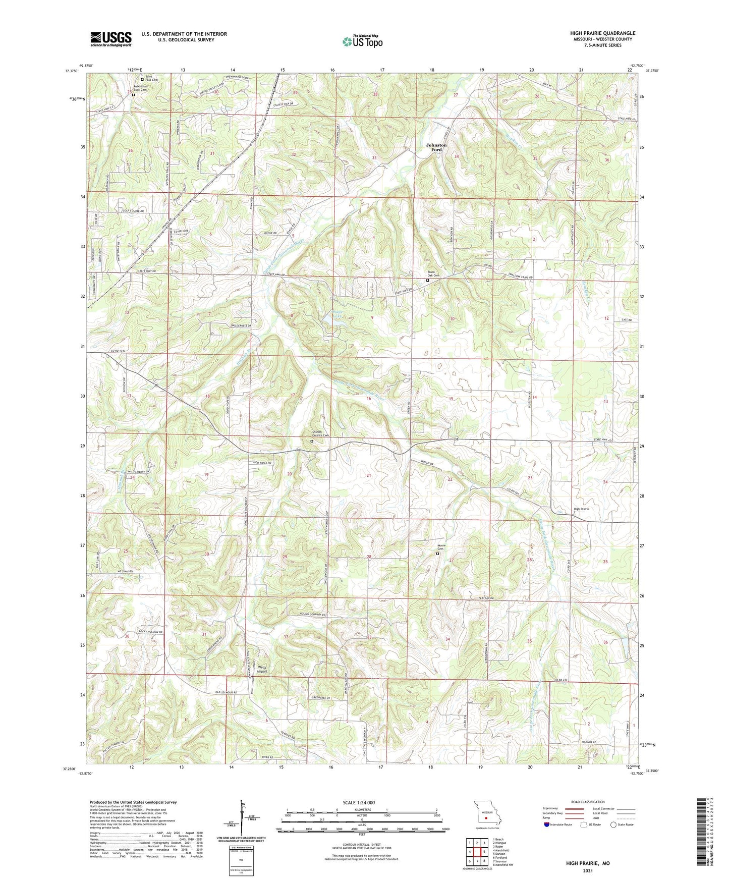
2021 topographic map quadrangle High Prairie in the state of Missouri. Scale: 1:24000. Based on the newly updated USGS 7.5' US Topo map series, this map is in the following counties: Webster. The map contains contour data, water features, and other items you are used to seeing on USGS maps, but also has updated roads and other features. This is the next generation of topographic maps. Printed on high-quality waterproof paper with UV fade-resistant inks.
Quads adjacent to this one:
West: Marshfield
Northwest: Beach
North: Niangua
Northeast: Rader
East: Duncan
Southeast: Mansfield NW
South: Seymour
Southwest: Fordland
This map covers the same area as the classic USGS quad with code o37092c7.
Contains the following named places: Black Oak Cemetery, Black Oak Church, Black Oak School, Bracken, Bracken Bridge, Bracken Creek, Burk Bridge Company East Lake Dam, Burk Bridge Company West Lake Dam, Camp Arrowhead, Camp Arrowhead Dam, Corinth Church, Dudley Church, Ebenezer Church, Eighty Eight School, Good Hope Church, Good Hope School, Hannah Branch, High Prairie, High Prairie Church, High Prairie School, Johnston Ford, Letchworth School, Moore Cemetery, Old Liberty Church, Osage Church, Osage Lake, Osage School, Rader Bridge Cemetery, Rocky Point School, Saint Paul Cemetery, Seventh Day Adventist Church, Shields - Corinth Cemetery, Township of East Ozark, Township of High Prairie, Wells Airport