MyTopo
Marshfield Missouri US Topo Map
Couldn't load pickup availability
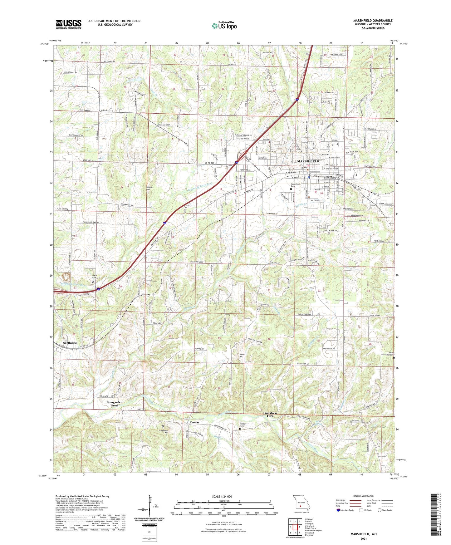
2021 topographic map quadrangle Marshfield in the state of Missouri. Scale: 1:24000. Based on the newly updated USGS 7.5' US Topo map series, this map is in the following counties: Webster. The map contains contour data, water features, and other items you are used to seeing on USGS maps, but also has updated roads and other features. This is the next generation of topographic maps. Printed on high-quality waterproof paper with UV fade-resistant inks.
Quads adjacent to this one:
West: Strafford
Northwest: Elkland
North: Beach
Northeast: Niangua
East: High Prairie
Southeast: Seymour
South: Fordland
Southwest: Oak Grove Heights
This map covers the same area as the classic USGS quad with code o37092c8.
Contains the following named places: Anderson School, Bell Spring, Biggs Lower Lake Dam, Bumgarden Ford, Calvary Church, Church of Christ, City of Marshfield, Clifton Cemetery, Clubhouse Creek, Crown, Crown School, Dailey School, Dry Creek, Edwards Chapel, Friendship Cemetery, Friendship Church, Greenwood School, KMRF-AM (Marshfield), Lacey Branch, Lindstrew Ford, Marshfield, Marshfield Cemetery, Marshfield Fire Department Station 1, Marshfield Fire Department Station 3, Marshfield Fire Protection District, Marshfield Police Department, Marshfield Post Office, Marshfield Shopping Center, Marshfield Village Shopping Center, Mount Sinai Cemetery, Mount Sinai Church, Northview, Number 796 Dam, Oak Hill School, Osborn Cemetery, Ragsdale Creek, Saint James School, Shockey School, Thomas Cemetery, Township of Marshfield, Township of Marshfield East, Township of Marshfield West, Township of Northview, Township of Ozark, Township of West Ozark, Turnbo Creek, Webster County, Webster County Sheriff's Office, Welch Cemetery, Welles Church, ZIP Code: 65706