MyTopo
Skidmore Missouri US Topo Map
Couldn't load pickup availability
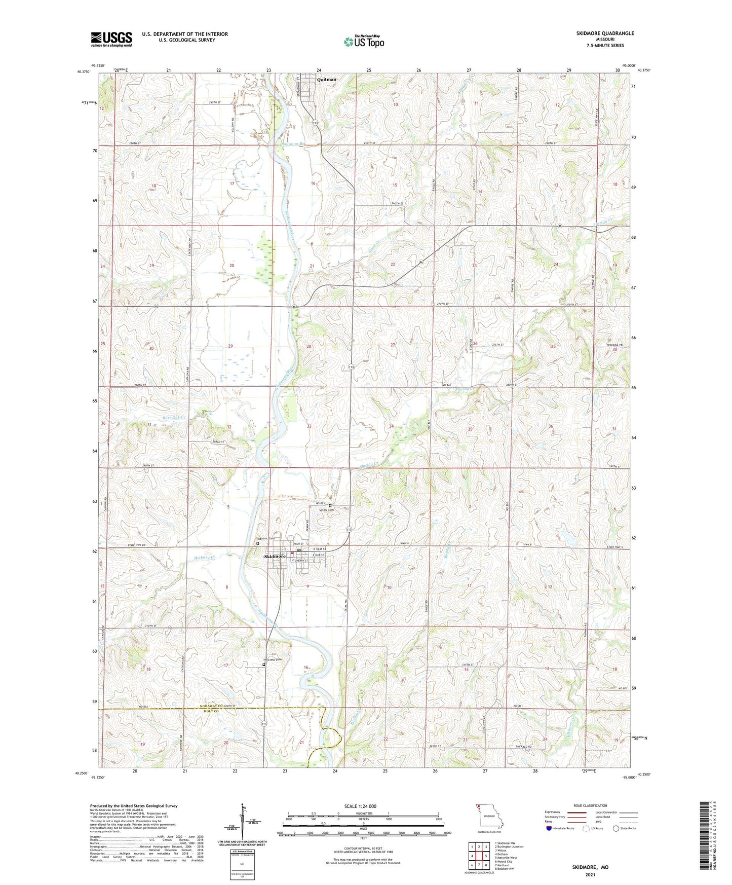
2021 topographic map quadrangle Skidmore in the state of Missouri. Scale: 1:24000. Based on the newly updated USGS 7.5' US Topo map series, this map is in the following counties: Nodaway, Holt. The map contains contour data, water features, and other items you are used to seeing on USGS maps, but also has updated roads and other features. This is the next generation of topographic maps. Printed on high-quality waterproof paper with UV fade-resistant inks.
Quads adjacent to this one:
West: Dotham
Northwest: Skidmore NW
North: Burlington Junction
Northeast: Wilcox
East: Maryville West
Southeast: Bolckow NW
South: Maitland
Southwest: Mound City
Contains the following named places: Bagby Creek, Bowman Branch, Burr Oak Creek, Centenary Church, City of Skidmore, Florida Creek, Hickory Creek, Hillcrest Cemetery, Huff Creek, Liberty School, Masonic Cemetery, Quitman, Quitman Census Designated Place, Royster School, Sand Creek, Skidmore, Skidmore Cemetery, Skidmore Post Office, Skidmore Volunteer Fire Protection District, Smith Cemetery, Tarpley School, Town of Quitman, Township of Green, Township of Monroe, ZIP Code: 64487