MyTopo
Burlington Junction Missouri US Topo Map
Couldn't load pickup availability
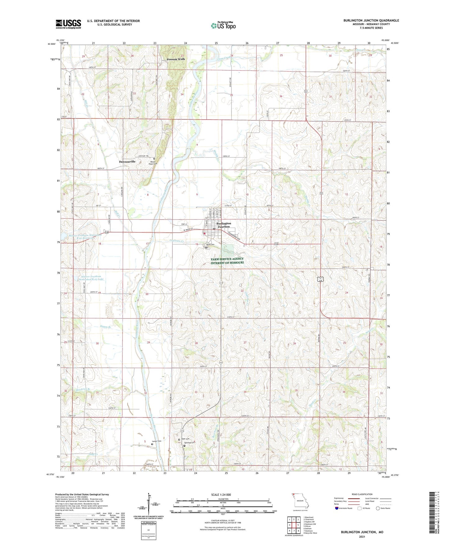
2021 topographic map quadrangle Burlington Junction in the state of Missouri. Scale: 1:24000. Based on the newly updated USGS 7.5' US Topo map series, this map is in the following counties: Nodaway. The map contains contour data, water features, and other items you are used to seeing on USGS maps, but also has updated roads and other features. This is the next generation of topographic maps. Printed on high-quality waterproof paper with UV fade-resistant inks.
Quads adjacent to this one:
West: Skidmore NW
Northwest: Blanchard
North: Clearmont
Northeast: Hopkins SW
East: Wilcox
Southeast: Maryville West
South: Skidmore
Southwest: Dotham
This map covers the same area as the classic USGS quad with code o40095d1.
Contains the following named places: Burlington Junction, Burlington Junction Post Office, Carter School, City of Burlington Junction, Clear Creek, Cuyhoga Creek, Dawsonville, Evans School, Hagey Branch, Hagey School, Hardesty School, Headrick Branch, Hedge College School, Hester Airport, Hoover Frankum Watershed B 20 Reservoir, Hoover Frankum Watershed B-23 Dam, Hoover Frankum Watershed B-23 Lake, Hoover Frankum Watershed Structure B-20 Dam, IOOF Cemetery, Lamar Cemetery, Little Brick School, Mill Creek, Mount Hope Cemetery, Muddy Creek, Ohio Cemetery, Pleasant Valley School, Possum Walk, Quitman Cemetery, Roseberry, Star School, Township of Nodaway, West Nodaway Elementary School, West Nodaway Fire Protection District, West Nodaway High School, ZIP Code: 64428