MyTopo
Spring Bluff Missouri US Topo Map
Couldn't load pickup availability
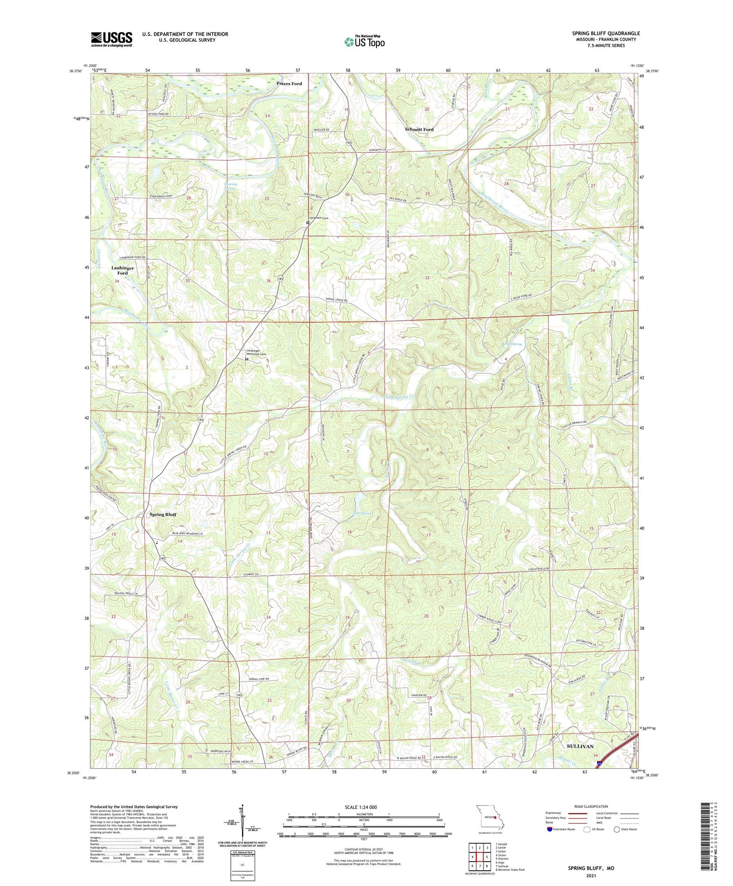
2021 topographic map quadrangle Spring Bluff in the state of Missouri. Scale: 1:24000. Based on the newly updated USGS 7.5' US Topo map series, this map is in the following counties: Franklin. The map contains contour data, water features, and other items you are used to seeing on USGS maps, but also has updated roads and other features. This is the next generation of topographic maps. Printed on high-quality waterproof paper with UV fade-resistant inks.
Quads adjacent to this one:
West: Strain
Northwest: Gerald
North: Leslie
Northeast: Union
East: Stanton
Southeast: Meramec State Park
South: Sullivan
Southwest: Argo
Contains the following named places: Ausbin Creek, Bandy Creek, Big Creek, Boehms Creek, Cave Spring Church, Cave Spring School, Duncan Lake Dam, Evergreen Cemetery, Evergreen Church, Evergreen Landing Field, Friedel Lake Dam, Koedding Lake Dam, Kratz Spring, Laubinger Ford, Laubinger Memorial Cemetery, Lawrence Schroepfer Reservoir, Little Spring Creek, Lollar Branch, Long Ridge School, Miller School, Pea Ridge School, Peters Ford, Pieper Lake Dam, Progress School, Roaring Spring, Rueppele Mine, Schmitt Ford, School Number 15, Schroepfer Lake Dam, Sour Spring, Spring Bluff, Spring Bluff School, Spring Creek, Stivers School, Winsel Creek