MyTopo
Steele Missouri US Topo Map
Couldn't load pickup availability
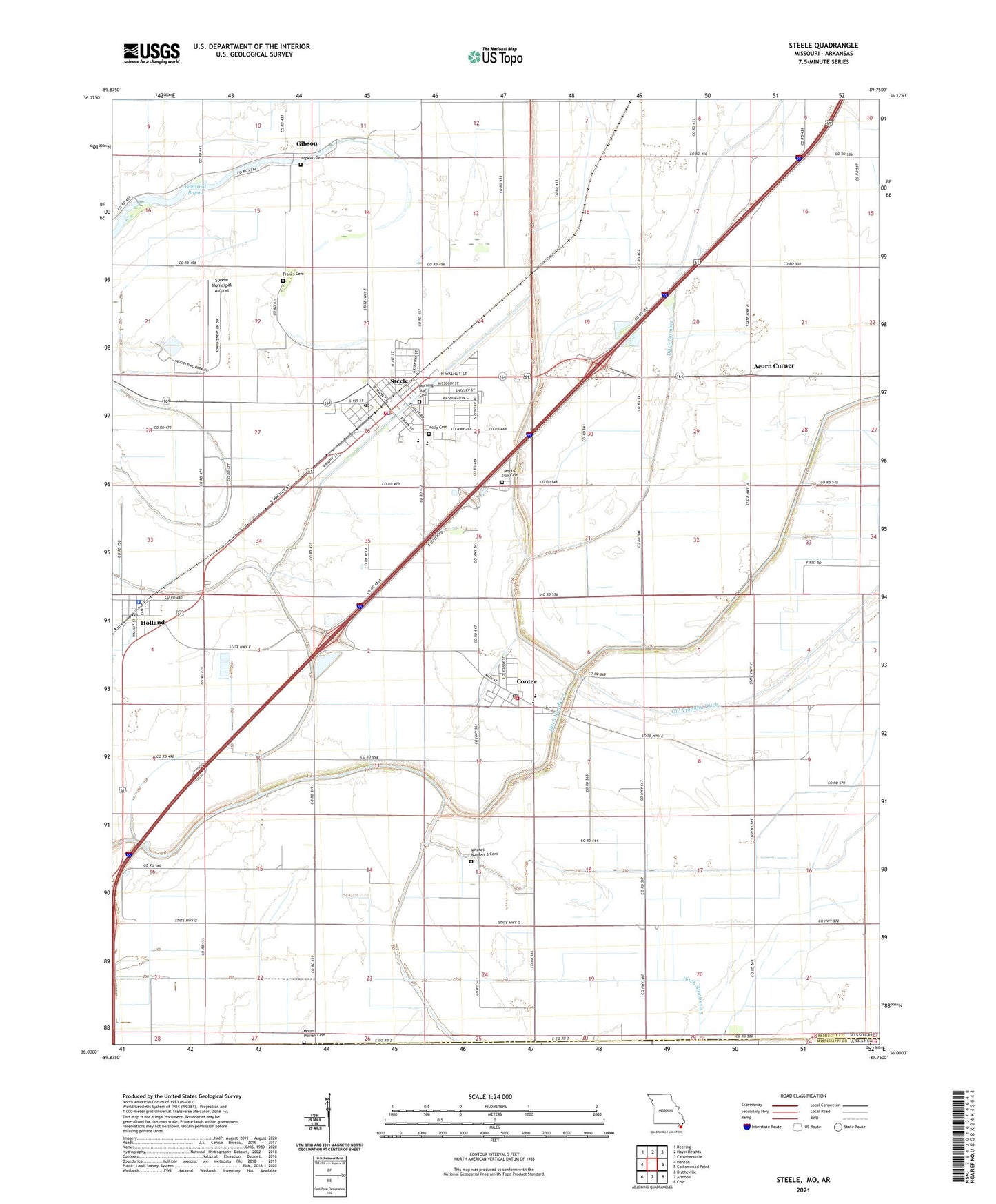
2021 topographic map quadrangle Steele in the state of Missouri. Scale: 1:24000. Based on the newly updated USGS 7.5' US Topo map series, this map is in the following counties: Pemiscot, Mississippi. The map contains contour data, water features, and other items you are used to seeing on USGS maps, but also has updated roads and other features. This is the next generation of topographic maps. Printed on high-quality waterproof paper with UV fade-resistant inks.
Quads adjacent to this one:
West: Denton
Northwest: Deering
North: Hayti Heights
Northeast: Caruthersville
East: Cottonwood Point
Southeast: Chic
South: Armorel
Southwest: Blytheville
Contains the following named places: Acorn Corner, Barnard Cemetery, Boones Chapel, Choctaw, City of Cooter, City of Steele, Cooter, Cooter Police Department, Cooter Post Office, Cooter Volunteer Fire Department, Ditch Number 3, Ditch Number 45, Ditch Number 5, Douglas, Douglas School, Fairbanks, Frakes Cemetery, Gibson, Gibson School, Hall, Holbert Corner, Holland, Holland Police Department, Holland Post Office, Holly Cemetery, Hopkins Cemetery, Kings Chapel, Lake Farms School, Maplewood School, Mitchell Number 8 Cemetery, Mount Moriah Cemetery, Mount Moriah Church, Mount Zion Cemetery, Mount Zion Church, New Franklin Ditch, Number Eight School, Oak Ridge, Oak Ridge Church, Old Franklin Ditch, Pemiscot Bayou, Pemiscot Bayou Dam, Pemiscot Bayou Lake, Persimmon Grove School, Pulltight School, Saint Paul Church, Steele, Steele Fire Department, Steele Municipal Airport, Steele Police Department, Steele Post Office, Town of Holland, Township of Cooter, Washington School, ZIP Codes: 63839, 63853, 63877