MyTopo
Denton Missouri US Topo Map
Couldn't load pickup availability
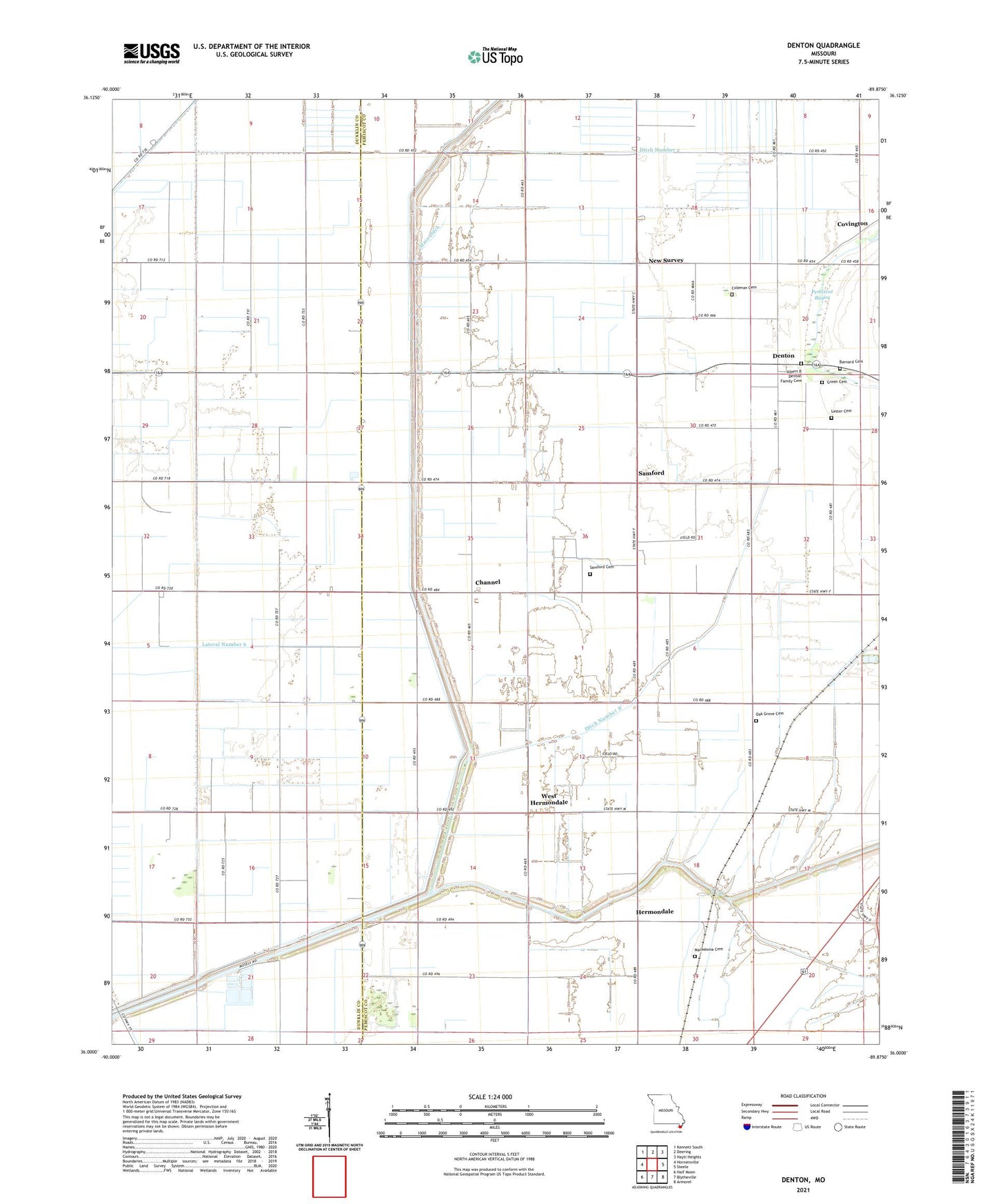
2021 topographic map quadrangle Denton in the state of Missouri. Scale: 1:24000. Based on the newly updated USGS 7.5' US Topo map series, this map is in the following counties: Pemiscot, Dunklin. The map contains contour data, water features, and other items you are used to seeing on USGS maps, but also has updated roads and other features. This is the next generation of topographic maps. Printed on high-quality waterproof paper with UV fade-resistant inks.
Quads adjacent to this one:
West: Hornersville
Northwest: Kennett South
North: Deering
Northeast: Hayti Heights
East: Steele
Southeast: Armorel
South: Blytheville
Southwest: Half Moon
This map covers the same area as the classic USGS quad with code o36089a8.
Contains the following named places: Assembly of God Church, Barnard Cemetery, Belle Fountain Ditch, Channel, Coleman Cemetery, Community Center Building, Covington, Culbertson Community Center, Denton, Denton Census Designated Place, Ditch Number 2, Ditch Number 4, Ditch Number 7, Ditch Number 8, Drakes School, Green Cemetery, Green Church, Hermondale, Hermondale Church, Hermondale School, Kilborn Church, Kilborn School, Lateral Number 6, Lester Cemetery, Macedonia Cemetery, Macedonia Church, Main Ditch, Main Ditch Number 1, Main Ditch Number 2, New Survey, New Survey School, Oak Grove Cemetery, Oak Grove Church, Pleasant Grove Church, Saint Matthews Church, Saint Matthews School, Saint Paul Church, Saint Paul School, Samford, Samford Cemetery, Samford Church, Samford School, Shady Grove Church, State Line, Temples Corner, Township of Holland, Township of Virginia, West Hermondale, Westbrook, Zion Rock Church