MyTopo
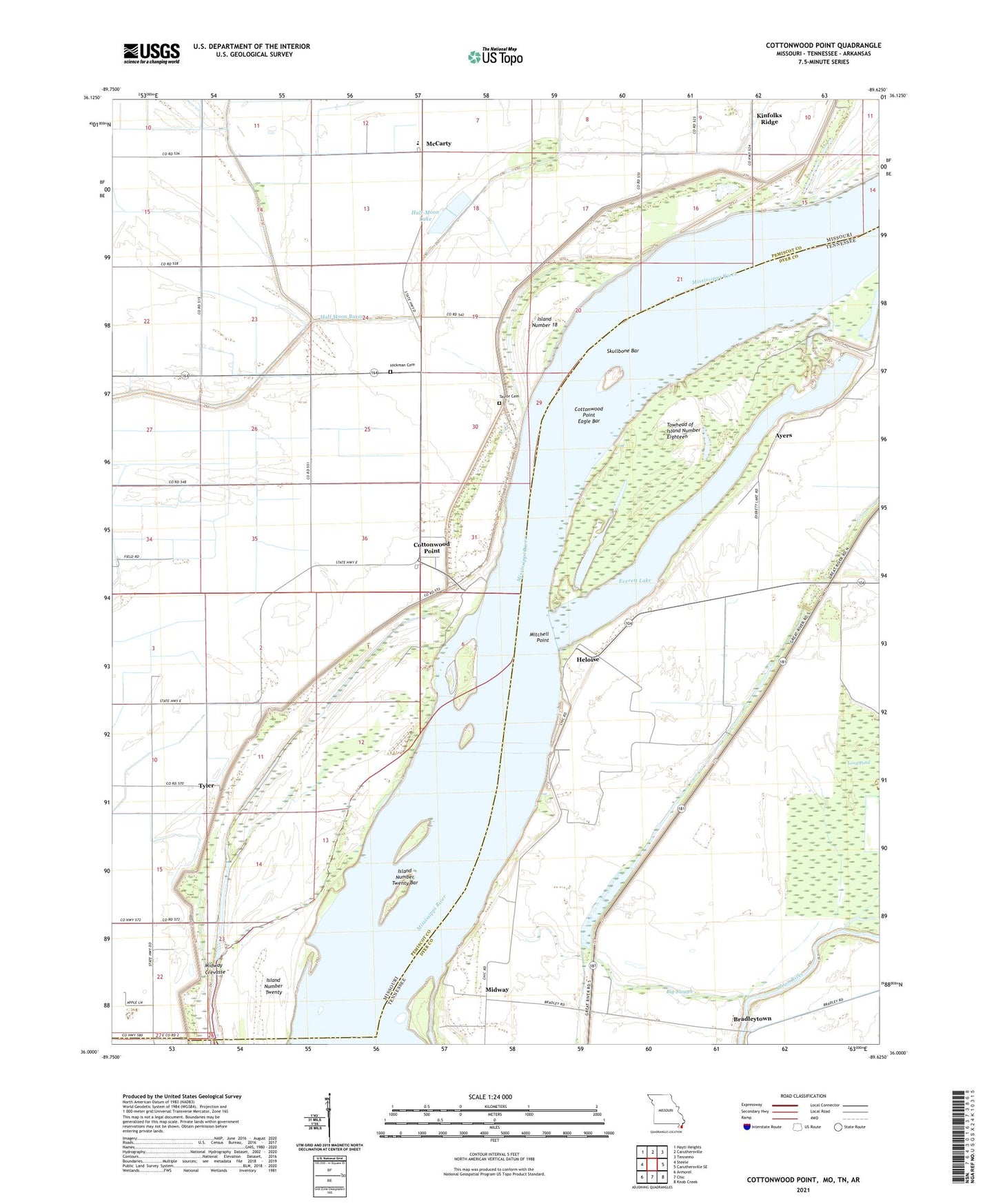
Cottonwood Point Missouri US Topo Map
Couldn't load pickup availability
2021 topographic map quadrangle Cottonwood Point in the states of Missouri, Tennessee. Scale: 1:24000. Based on the newly updated USGS 7.5' US Topo map series, this map is in the following counties: Pemiscot, Dyer, Mississippi. The map contains contour data, water features, and other items you are used to seeing on USGS maps, but also has updated roads and other features. This is the next generation of topographic maps. Printed on high-quality waterproof paper with UV fade-resistant inks.
Quads adjacent to this one:
West: Steele
Northwest: Hayti Heights
North: Caruthersville
Northeast: Tennemo
East: Caruthersville SE
Southeast: Knob Creek
South: Chic
Southwest: Armorel
Contains the following named places: Ashland Towhead, Ayers, Ayers Landing, Bader Bar, Big Slough, Bradleytown, Cottonwood Point, Cottonwood Point Census Designated Place, Cottonwood Point Dikes, Cottonwood Point Eagle Bar, Cottonwood Point Ferry, Cottonwood Point Landing, Everett Lake, Flag Lake School, Half Moon Bayou, Half-Moon Lake, Half-Moon Lake Dam, Head of Island Number Twentyone Dikes, Heloise, Heloise Landing, Heloise Revetment, Hickman Cemetery, Hunter School, Island Number 18, Island Number Twenty, Island Number Twenty Bar, Kinfolks Ridge, Long Pond, McCarty, McCarty School, Midway, Midway Crevasse, Mitchell Point, Needmore School, Pleasant Grove Church, Riverside Church, Skullbone, Skullbone Bar, Stake Slough, Taylor Cemetery, Towhead of Island Number Eighteen, Township of Pemiscot, Tyler