MyTopo
Deering Missouri US Topo Map
Couldn't load pickup availability
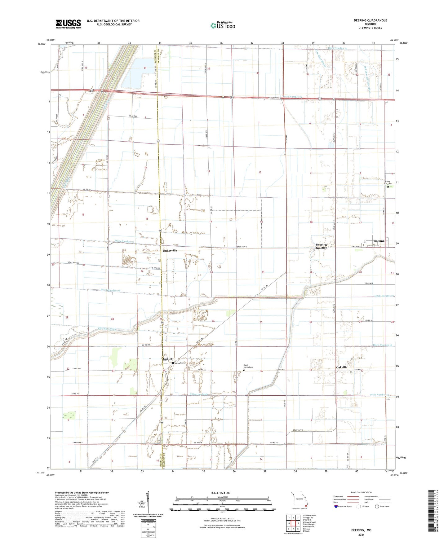
2021 topographic map quadrangle Deering in the state of Missouri. Scale: 1:24000. Based on the newly updated USGS 7.5' US Topo map series, this map is in the following counties: Pemiscot, Dunklin. The map contains contour data, water features, and other items you are used to seeing on USGS maps, but also has updated roads and other features. This is the next generation of topographic maps. Printed on high-quality waterproof paper with UV fade-resistant inks.
Quads adjacent to this one:
West: Kennett South
Northwest: Kennett North
North: Bragg City
Northeast: Wardell
East: Hayti Heights
Southeast: Steele
South: Denton
Southwest: Hornersville
This map covers the same area as the classic USGS quad with code o36089b8.
Contains the following named places: Bakerville, Bethel Church, Bethel School, Clay Root Bayou, Deco, Deepwater Church, Deering, Deering Census Designated Place, Deering Junction, Deering Post Office, Delta C-7 School, Ditch Number 16, Ditch Number 17, Ditch Number 73, Ditch Number 74, Ditch Number 75, Ditch Number 76, Ditch Number 77, Ditch Number 78, Friendship School, Gibbons, Gobler, Gobler Church, Gobler Post Office, Hillsman Taylor Church, Jones Cemetery, Little River Church, Little River School, Mackeys, Mapleview Church, Mid City, Mid City Church, New Survey School, North Deering Ditch, Oak Grove Church, Oakville, Old Channel Little River, Oreena Church, Rising Star Cemetery, Saint Johns Cemetery, Tinkerville, Township of Braggadocio, United Church, ZIP Code: 63849