MyTopo
Tarsney Lakes Missouri US Topo Map
Couldn't load pickup availability
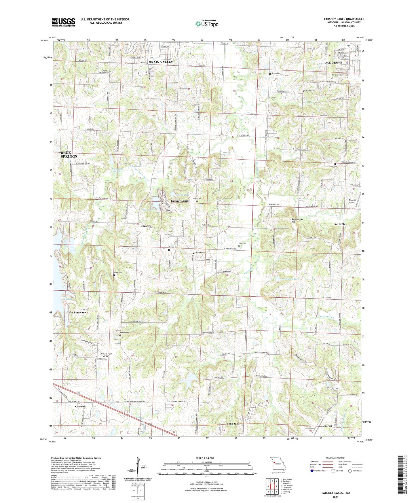
2021 topographic map quadrangle Tarsney Lakes in the state of Missouri. Scale: 1:24000. Based on the newly updated USGS 7.5' US Topo map series, this map is in the following counties: Jackson. The map contains contour data, water features, and other items you are used to seeing on USGS maps, but also has updated roads and other features. This is the next generation of topographic maps. Printed on high-quality waterproof paper with UV fade-resistant inks.
Quads adjacent to this one:
West: Lake Jacomo
Northwest: Blue Springs
North: Oak Grove
Northeast: Bates City
East: Chapel Hill
Southeast: Elm
South: Strasburg
Southwest: Pleasant Hill
Contains the following named places: Adams Cemetery, Alley Cemetery, Aylward Lake, Aylward Lake Dam, Briggs Lake Dam, Brown Cemetery, Cockrell, Corn Cemetery, George Cemetery, Gosney Cemetery, Grain Valley Middle School, Hillside School, Koger Cemetery, Lake Lotawana, Lake Lotawana Dam, Lambs Field, Lone Jack Elementary School, Lone Jack Lake Conservation Area, Lotawana Church, Michael Farm Airport, Mononame 83 Dam, Mononame 83 Lake, Moreland School, Morris Lake Dam, New Liberty Church, Oak Grove Cemetery, Oak Grove Police Department, Oak Grove Post Office, Oak Hill School, Perdue Cemetery, Powell School, Powis Airport, Pueblo School, Purdee Chapel Cemetery, Rattlesnake Hill, Sni Mill, Sni Mills, Sni Mills Church, Sni Valley Fire Protection District Main Station, Stony Point Elementary School, Stony Point School, Tarsney, Tarsney Lake, Tarsney Lake Dam, Tarsney Lakes, Tarsney Lakes Census Designated Place, Tarsney School, Thomas Airport, Township of Van Buren, West Fork Sni-A-Bar Creek, Wide Awake School, Wood Lake, Wood Lake Dam, ZIP Codes: 64070, 64075