MyTopo
Vastus Missouri US Topo Map
Couldn't load pickup availability
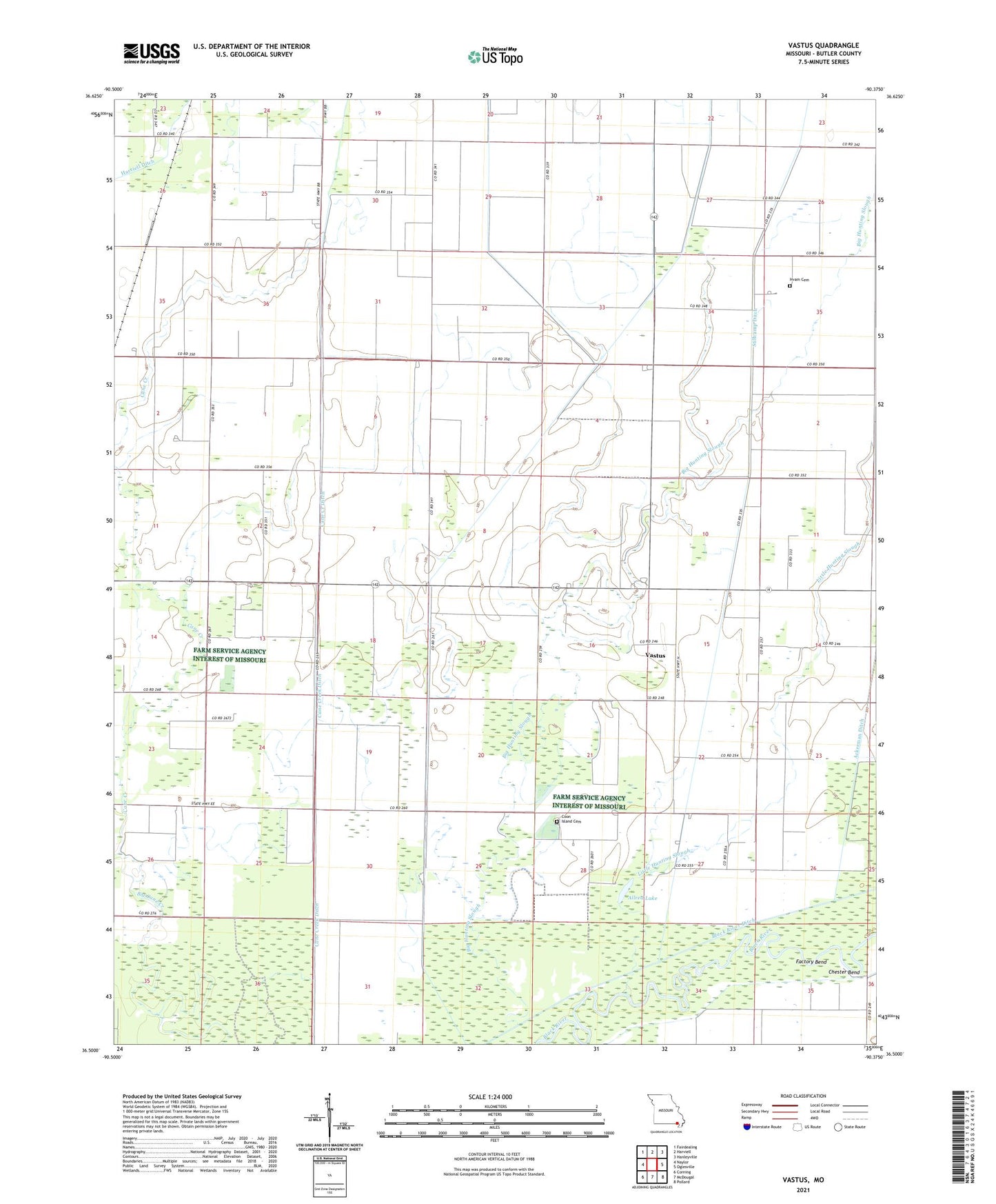
2021 topographic map quadrangle Vastus in the state of Missouri. Scale: 1:24000. Based on the newly updated USGS 7.5' US Topo map series, this map is in the following counties: Butler. The map contains contour data, water features, and other items you are used to seeing on USGS maps, but also has updated roads and other features. This is the next generation of topographic maps. Printed on high-quality waterproof paper with UV fade-resistant inks.
Quads adjacent to this one:
West: Naylor
Northwest: Fairdealing
North: Harviell
Northeast: Hanleyville
East: Oglesville
Southeast: Pollard
South: McDougal
Southwest: Corning
Contains the following named places: Allred Lake, Barks Church, Big Hunting Slough, Bordens School, Burdett Landing, Butler County Fire Protection District Coon Island Station, Cane Creek, Cane Creek Ditch, Chester Bend, Conley Grove Church, Coon Island Cemetery, Coon Island School, El Bethel Church, Factory Bend, Friendship Church, Havam School, Hvam Cemetery, Little Hunting Slough, New Hope School, New Morning Star Church, Stillcamp Church, Stillcamp Ditch, Township of Coon Island, Vastus, Walsh, ZIP Code: 63954