MyTopo
Wappapello Missouri US Topo Map
Couldn't load pickup availability
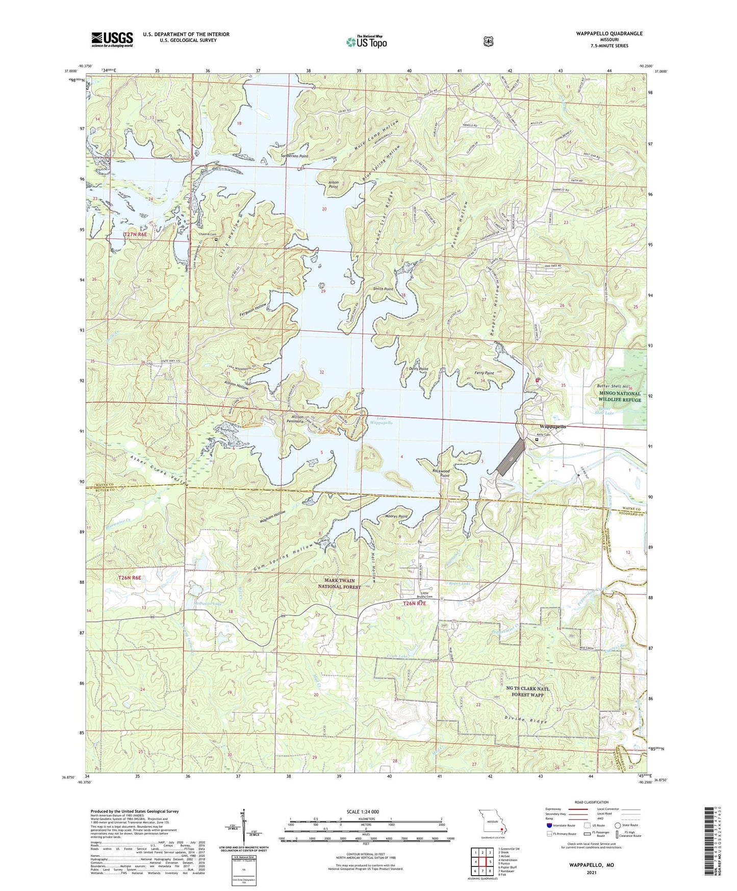
2021 topographic map quadrangle Wappapello in the state of Missouri. Scale: 1:24000. Based on the newly updated USGS 7.5' US Topo map series, this map is in the following counties: Wayne, Butler, Stoddard. The map contains contour data, water features, and other items you are used to seeing on USGS maps, but also has updated roads and other features. This is the next generation of topographic maps. Printed on high-quality waterproof paper with UV fade-resistant inks.
Quads adjacent to this one:
West: Hendrickson
Northwest: Greenville SW
North: Shook
Northeast: McGee
East: Puxico
Southeast: Fisk
South: Rombauer
Southwest: Poplar Bluff
Contains the following named places: Allison Hollow, Allison Peninsula, Allison School, Anson Point, Asher Creek, Asher Creek Valley, Blue Spring Hollow, Bluewater Creek, Brower School, Butler County Fire Protection District Rockwood Station, Butler School, Butter Shell Hill, Butter Shell Lake, Camp Latonka, Chaonia, Chaonia Cemetery, Chaonia Landing Recreation Area, Crum Lake, Crum Lake Dam, Cypress Branch, Davis Air Ranch, Davis Point, Divide Ridge, Eagle Point Recreation Area, Ferguson Hollow, Ferry Point, Ferrys, Gum Spring Hollow, Hall Hollow, Kelly Cemetery, Lake Wappapello, Lake Wappapello State Park, Lilly Hollow, Little Brushy Church, Little Brushy School, Lone Star Ridge, Lost Creek, Lost Creek Nature Trail, Mayham Hollow, McDaniel Lake, Mill Creek, Moores Point, Mud Spring, Mule Camp Hollow, Paradise Point Recreation Area, Peoples Creek Recreation Area, Peoples Hollow, Peppermint Creek, Pine Ridge Nature Trail, Pisos Point Recreation Area, Possum Hollow, Redman Creek, Redman Creek Recreation Area, Rockwood Point, Rockwood Point Recreation Area, Roper Lake, Roper Lake Dam, Sanderson Point, Smith Farm, Smith Point, Snow Creek, Spillway Recreation Area, University of Missouri Forestry Camp, W L and Mary Hays North Dam, W L and Mary Hays South Dam, Walnut Cove Recreation Area, Wappapello, Wappapello Dam, Wappapello Post Office, Wappapello Training Site, Wappapello Volunteer Fire Department, ZIP Code: 63966