MyTopo
Fisk Missouri US Topo Map
Couldn't load pickup availability
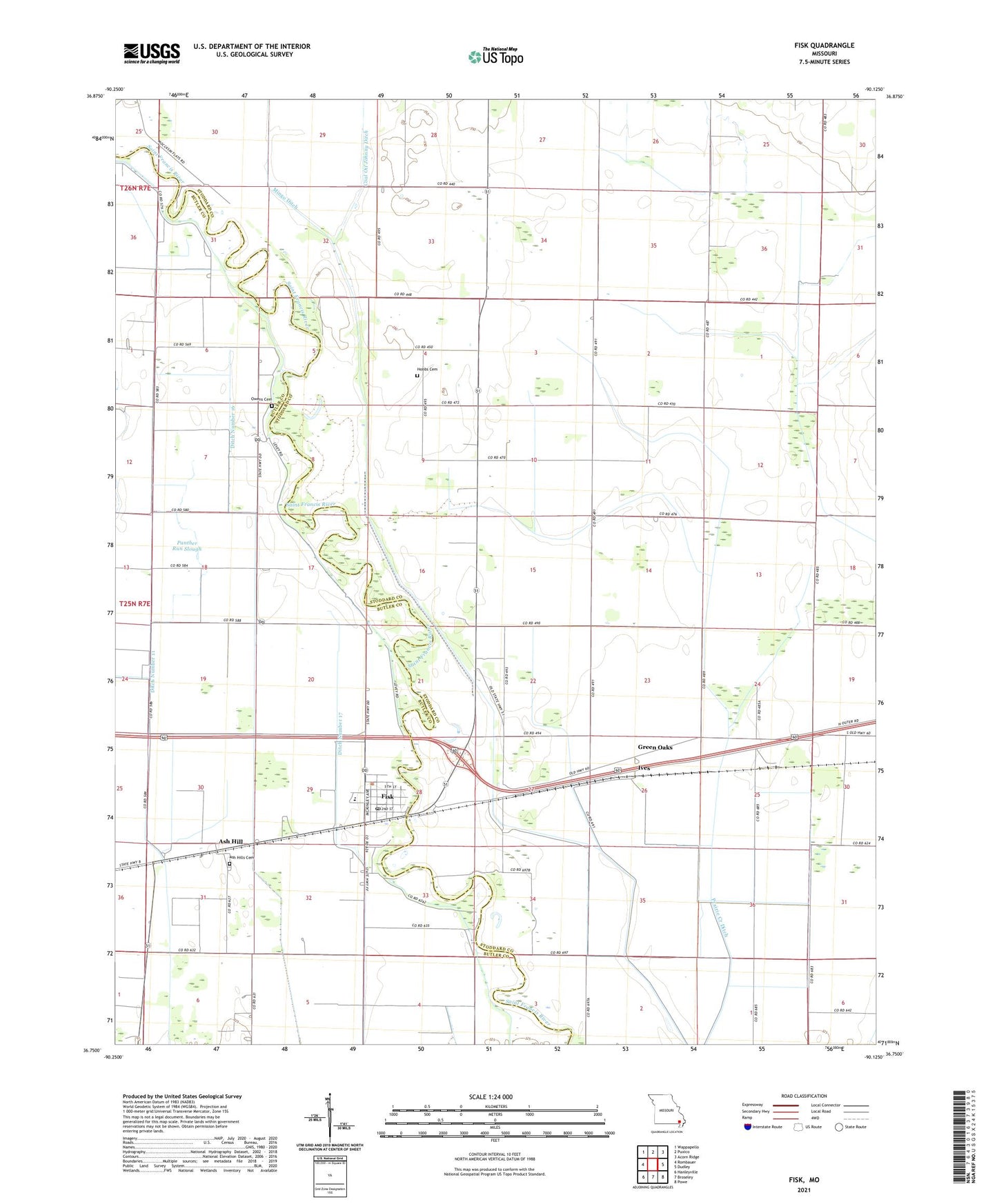
2021 topographic map quadrangle Fisk in the state of Missouri. Scale: 1:24000. Based on the newly updated USGS 7.5' US Topo map series, this map is in the following counties: Stoddard, Butler. The map contains contour data, water features, and other items you are used to seeing on USGS maps, but also has updated roads and other features. This is the next generation of topographic maps. Printed on high-quality waterproof paper with UV fade-resistant inks.
Quads adjacent to this one:
West: Rombauer
Northwest: Wappapello
North: Puxico
Northeast: Acorn Ridge
East: Dudley
Southeast: Powe
South: Broseley
Southwest: Hanleyville
This map covers the same area as the classic USGS quad with code o36090g2.
Contains the following named places: Ash Hill, Ash Hill School, Ash Hills Cemetery, Butler County Fire Protection District Fisk Station, City of Fisk, Ditch Number 11, Ditch Number 16, Ditch Number 17, Edmundson School, Fisk, Fisk Post Office, Fisk Volunteer Fire Department, Green Oaks, Hancock School, Hobbs Chapel, Hobbs School, Ives, Lakeview School, Little School, Mangrum School, Mingo Ditch, Open Lake School, Owens Cemetery, Panther Run Slough, Poplin, Poplin Ferry, Prairie Creek Ditch, Randol, Right Lake, Riverside Mill, Star Church, Star School, Zoll School, ZIP Codes: 63936, 63940