MyTopo
Wasola Missouri US Topo Map
Couldn't load pickup availability
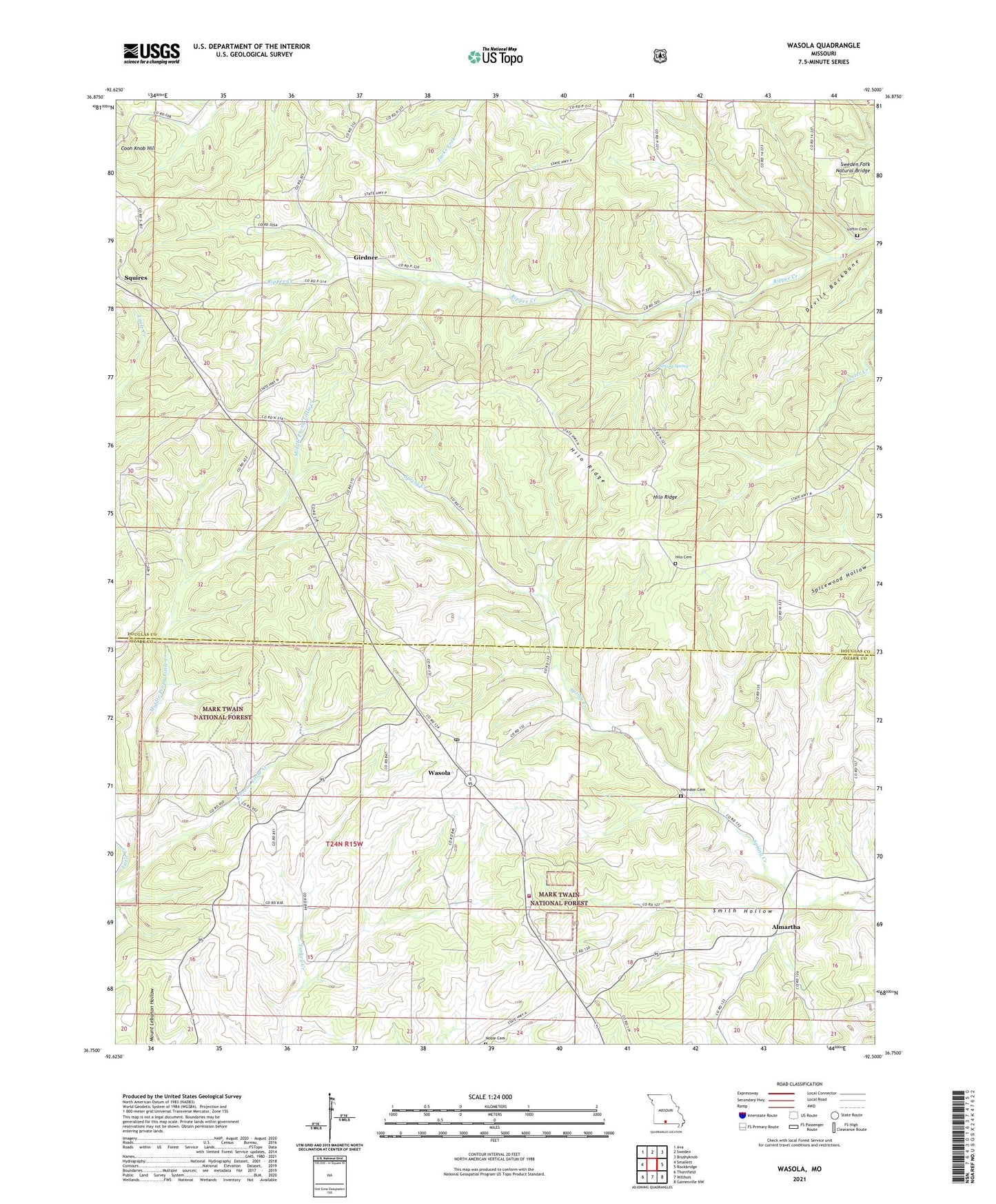
2021 topographic map quadrangle Wasola in the state of Missouri. Scale: 1:24000. Based on the newly updated USGS 7.5' US Topo map series, this map is in the following counties: Douglas, Ozark. The map contains contour data, water features, and other items you are used to seeing on USGS maps, but also has updated roads and other features. This is the next generation of topographic maps. Printed on high-quality waterproof paper with UV fade-resistant inks.
Quads adjacent to this one:
West: Smallett
Northwest: Ava
North: Sweden
Northeast: Brushyknob
East: Rockbridge
Southeast: Gainesville NW
South: Willhoit
Southwest: Thornfield
Contains the following named places: Almartha, Anchor School, Cobb School, Devils Backbone, Excelsior School, Girdner, Herndon Cemetery, Hilo, Hilo Cemetery, Hilo Ridge, Huckleberry School, Loftin Cemetery, Loftin Church, Loftin School, Murray Church, Noble Cemetery, North Ozark Church, Oak Grove Church, Oak Grove School, Pleasant Hill School, Silverton, Smith Hollow, Spicewood Hollow, Squires, Strong Spring, Sweden Fork Natural Bridge, Township of Noble, Township of Walls, Wasola, Wasola Census Designated Place, Wasola Fire Department, Wasola Post Office, ZIP Codes: 65755, 65773