MyTopo
Rockbridge Missouri US Topo Map
Couldn't load pickup availability
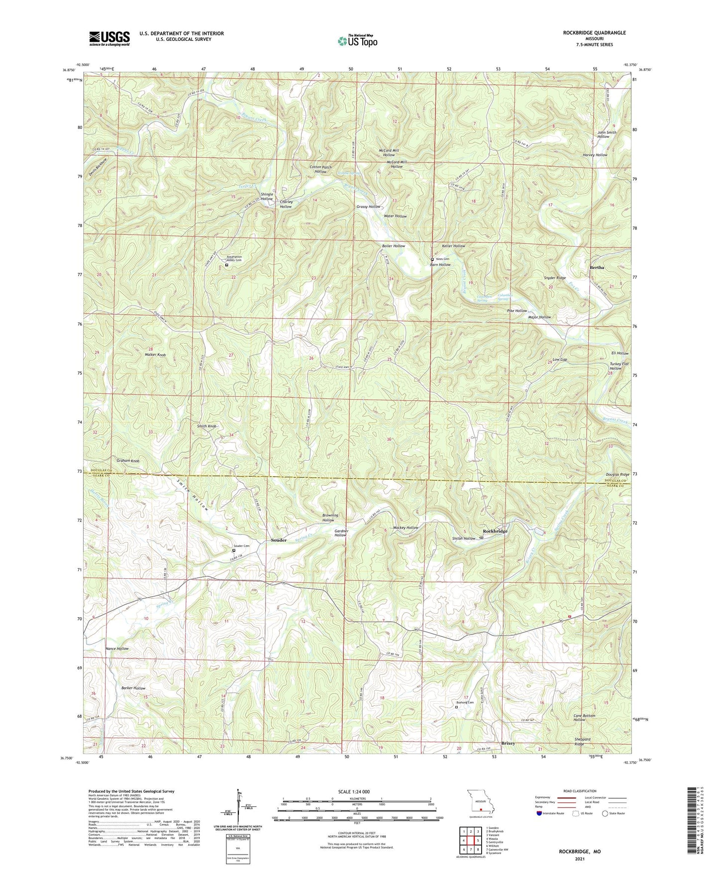
2021 topographic map quadrangle Rockbridge in the state of Missouri. Scale: 1:24000. Based on the newly updated USGS 7.5' US Topo map series, this map is in the following counties: Douglas, Ozark. The map contains contour data, water features, and other items you are used to seeing on USGS maps, but also has updated roads and other features. This is the next generation of topographic maps. Printed on high-quality waterproof paper with UV fade-resistant inks.
Quads adjacent to this one:
West: Wasola
Northwest: Sweden
North: Brushyknob
Northeast: Vanzant
East: Gentryville
Southeast: Sycamore
South: Gainesville NW
Southwest: Willhoit
This map covers the same area as the classic USGS quad with code o36092g4.
Contains the following named places: Assumption Abbey, Barker Hollow, Barn Hollow, Bertha, Bertha School, Boiler Hollow, Brixey, Brixey - Rockbridge Volunteer Fire Department, Brixey Creek, Browning Hollow, Charley Hollow, Columbus Spring, Coon Den Spring, Cotton Patch Hollow, Diamond School, Eli Hollow, Fielden, Fielden Post Office, Fielden School, Fox Creek, Gardner Hollow, Graham Knob, Grassy Hollow, Harris Brook, Harvey Hollow, Jackson Lake Dam, John Smith Hollow, Keller Hollow, Low Gap, Lower Brixey School, Mackey Hollow, Major Hollow, McCord Mill Hollow, Nance Creek, Nance Hollow, Pike Hollow, Pine Flat School, Pine Ridge Church, Rippee, Rippee Creek, Rippee State Wildlife Management Area, Rockbridge, Shiloh Hollow, Shingle Hollow, Smith Hollow, Smith Knob, Snyder Ridge, Souder, Souder Church, Spring Creek, Teeter Creek, Township of Brown, Township of Jackson, Trimble Spring, Turkey Flat Hollow, Turkey Flat School, Walker Knob, Water Hollow, Yates Cemetery