MyTopo
Gainesville NW Missouri US Topo Map
Couldn't load pickup availability
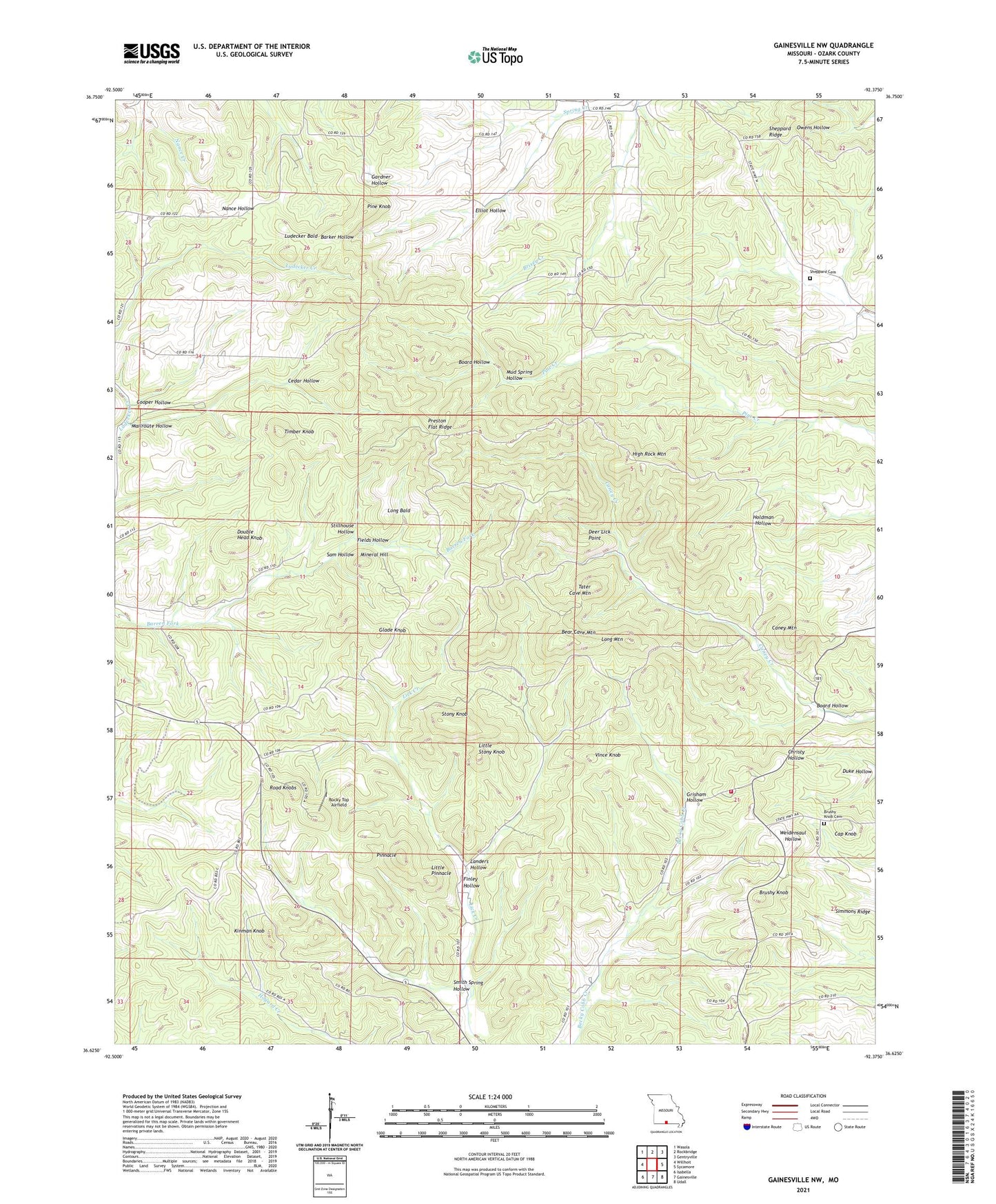
2021 topographic map quadrangle Gainesville NW in the state of Missouri. Scale: 1:24000. Based on the newly updated USGS 7.5' US Topo map series, this map is in the following counties: Ozark. The map contains contour data, water features, and other items you are used to seeing on USGS maps, but also has updated roads and other features. This is the next generation of topographic maps. Printed on high-quality waterproof paper with UV fade-resistant inks.
Quads adjacent to this one:
West: Willhoit
Northwest: Wasola
North: Rockbridge
Northeast: Gentryville
East: Sycamore
Southeast: Udall
South: Gainesville
Southwest: Isabella
This map covers the same area as the classic USGS quad with code o36092f4.
Contains the following named places: Bear Cave Mountain, Board Hollow, Brushy Knob, Brushy Knob Cemetery, Brushy Knob Church, Brushy Knob School, Bryant Volunteer Fire Department, Caney Mountain, Caney Mountain State Game Refuge, Caney Mountain Volunteer Fire Department, Cap Knob, Cedar Hollow, Cooper Hollow, Deer Lick Point, Double Head Knob, Duke Hollow, Elliot Hollow, Evening Shade School, Fields Hollow, Finley Hollow, Gardner Dam, Gardner Lake, Glade Knob, Grisham Hollow, Herd Dam, Herd Lake, High Rock Mountain, Kinman Knob, Landers Hollow, Little Pinnacle, Little Stony Knob, Long Bald, Long Mountain, Ludecker Bald, Mailroute Hollow, Mallow Lake, Mallow Lake Dam, Mineral Hill, Mud Spring Hollow, Nebraska School, Ozark County, Pine Knob, Pineview Church, Pineview School, Pinnacle, Preston Flat Ridge, Road Knobs, Rocky Top Airfield, Romance Lookout Tower, Sam Hollow, Sheppard Cemetery, Sheppard Ridge, Simmons Ridge, Smith Spring Hollow, Stillhouse Hollow, Stony Knob, Tater Cave Mountain, Timber Knob, Township of Barren Fork, Upper Brixey School, Vince Knob