MyTopo
Whitewater Missouri US Topo Map
Couldn't load pickup availability
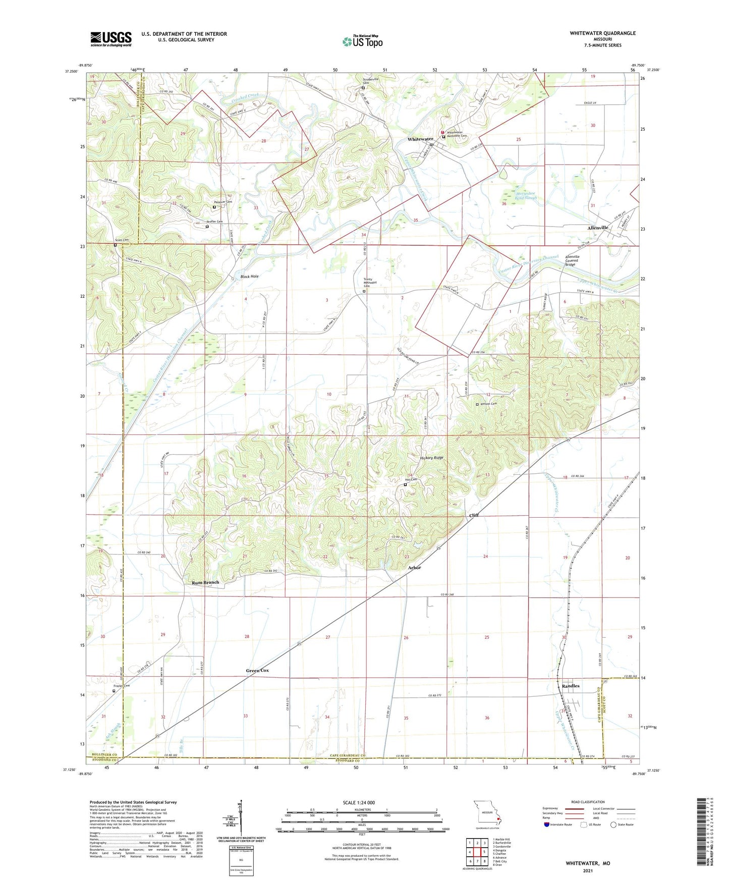
2021 topographic map quadrangle Whitewater in the state of Missouri. Scale: 1:24000. Based on the newly updated USGS 7.5' US Topo map series, this map is in the following counties: Cape Girardeau, Bollinger, Scott, Stoddard. The map contains contour data, water features, and other items you are used to seeing on USGS maps, but also has updated roads and other features. This is the next generation of topographic maps. Printed on high-quality waterproof paper with UV fade-resistant inks.
Quads adjacent to this one:
West: Dongola
Northwest: Marble Hill
North: Burfordville
Northeast: Gordonville
East: Chaffee
Southeast: Oran
South: Bell City
Southwest: Advance
Contains the following named places: Allenville, Allenville Covered Bridge, Arbor, Block Hole, Cliff, Council Ridge School, Crooked Creek, Ditch Ward School, Fairview Church, Frazier Cemetery, Gizzard Creek, Green Cox, Green Cox School, Hickory Ridge, Hickory Ridge School, Hitt Cemetery, Horseshoe Bend Slough, Kenyon Cemetery, Moore School, Oak Valley School, Passover Cemetery, Passover Church, Proffer Cemetery, Randles, Round Pond, Round Pond Church, Rum Branch, Rum Branch Church, School Number R 5, Scott Cemetery, Stroderville, Stroderville Cemetery, Stroderville School, Tank, Town of Whitewater, Township of Welch, Trinity Church, Upper Castor River, Village of Allenville, Whitewater, Whitewater Fire Protection District Station 1, Whitewater Post Office